First Alert Weather Days Sunday and Monday: Heavy rain, dangerous flooding and mountain snow expected in Colorado


Just one week after devastating flooding across southwest Colorado, another powerful storm is moving in. Unfortunately, rivers are expected to rise even higher this time.
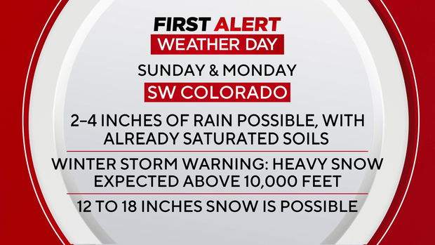
Sunday and Monday are First Alert Weather Days as a powerful storm brings the threat of dangerous flooding, heavy rain and significant mountain snow to parts of Colorado. The San Juan River in Pagosa Springs reached around 15 feet last week. Current data indicates a crest near 17 feet by early Monday. The record is 17.8 feet, set back in 1911.
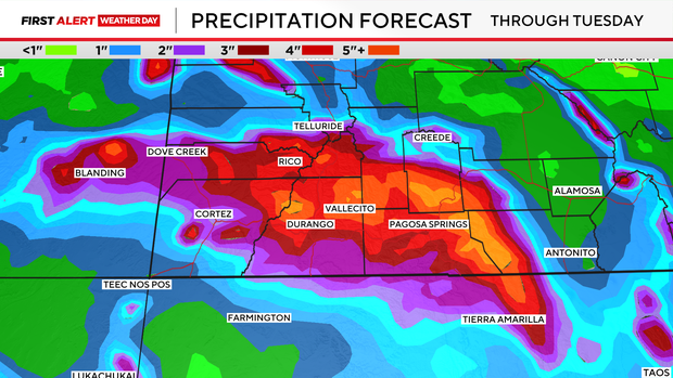
A Flood Watch is in effect through noon Monday across southwestern Colorado and southeastern Utah. Two to four inches of rain are possible across the southern San Juan Mountains, where soils remain saturated following last week's flooding. A Flood Warning is also in effect for the San Juan River near Pagosa Springs, with officials warning of a particularly dangerous situation. Another round of heavy rain could bring as much precipitation in the next 24 hours as the area received during the two day storm last week. Flooding is also possible along the Mancos, La Plata and Animas rivers.
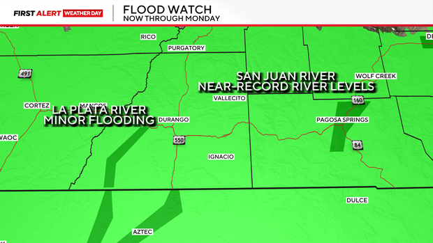
Mandatory evacuations are in effect for flood-prone areas of Pagosa Springs and along the San Juan, Piedra, Rio Blanco and Navajo rivers.
San Juan and Hermosa streets will close to through traffic beginning Sunday morning. Additional road closures, including portions of Highway 160, may be necessary.
An atmospheric river, essentially a corridor of moisture streaming in from the Pacific, is fueling this storm and bringing the potential for heavy rain and mountain snow.
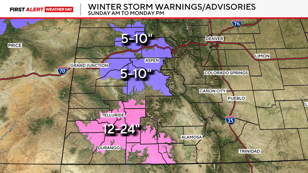
Heavy rain will change to snow at higher elevations. A Winter Storm Warning is in effect for the San Juan Mountains above 10,000 feet, where 12 to 24 inches of snow could accumulate through Monday. Hazardous driving conditions are expected over higher mountain passes.
A Winter Weather Advisory is also in effect for the Flat Tops and central Colorado mountains, where 5 to 10 inches of snow are possible tonight into Monday.
A Special Avalanche Advisory is in effect for parts of the Southern and Central Mountains through Monday.
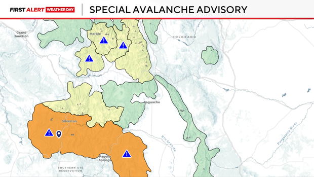
The Colorado Avalanche Information Center (CAIC) says avalanche danger will increase rapidly Sunday and could reach High (Level 4 of 5) above treeline in parts of the San Juan and Elk Mountains by Monday. Large natural avalanches are possible, especially late Sunday into Monday.
The storm will make its way to the Front Range by Monday. Monday will start out with the chance for fog and light rain with scattered showers possible in the afternoon and evening.
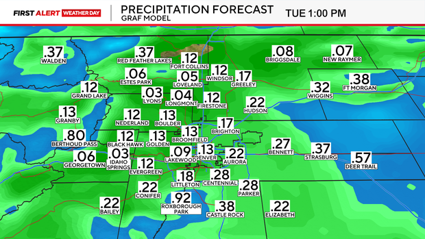
By Election Day conditions look to be mild and sunny.