Colorado Is Known For Heavy March Snow, One Storm Ended Record Drought In 2003
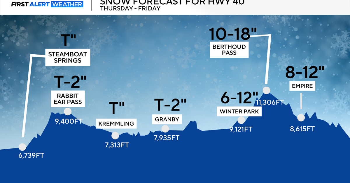
DENVER (CBS4) - Get ready for a lot of chatter this week about Colorado's weather, especially on social media. Computer forecast models show the potential for a high-impact winter storm moving into the state sometime after Wednesday. As we see it now this storm could drop a large amount of moisture and it could be mostly in the form of snow, so it is something you will want to pay close attention to this week.
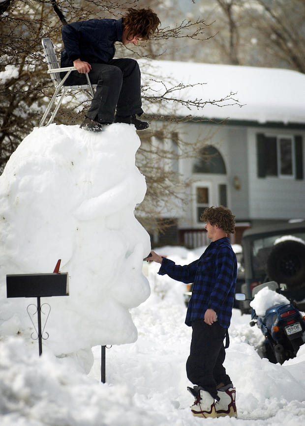
If you've been in Colorado for any length of time then talk of this approaching weather system probably brings back fond memories. It hasn't been this dry in the state since the record drought year of 2002, which was abruptly ended when a historic blizzard slammed the region in March 2003.
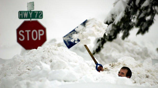
The multi-day storm dropped up to 3 feet of snow around metro Denver with more than 7 feet in the adjacent foothills between March 17-19. Strong northerly winds produced drifts in Denver up to 6 feet tall.
PHOTO GALLERY: The Blizzard Of 2003
Widespread damage was reported to trees, roofs and power lines because the snow was so heavy and wet.
March is known for being a snowy month in the Central Rockies, and with Colorado facing a very uncertain summer when it comes to water supply, talk about this storm conjures up hope and excitement. According to NOAA's National Center for Environmental Information 2020 was the second driest year on record in the state since 1895.
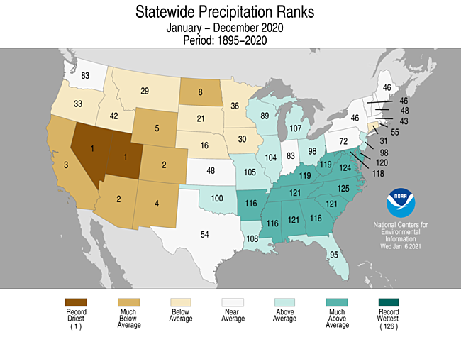
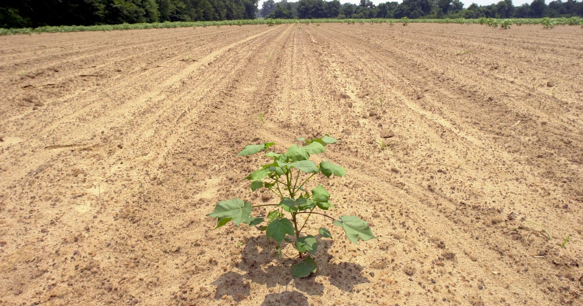
Drought is a frequent visitor to Colorado and is often found in some part of the state. Our large size, complex topography and great distance from oceans make this a climate reality. We depend on the jet stream to bring a consistent storm track to the state to meet our water needs. If that isn't happening then drought develops.
Many times we'll see a few dry months where drought develops, but it is often in just a portion of the state, or it will be followed by a wet period that either resolves things or at least keeps the drought from getting worse. But in recent history we find ourselves getting into longer periods of dryness where drought becomes widespread and reaches extreme to exceptional levels. The years 2002, 2012 and 2013 come to mind, in addition to other shorter bouts of widespread drought in years such as 2006, 2018 and 2019.
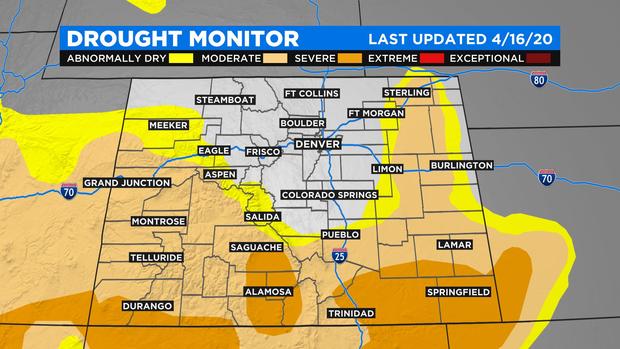
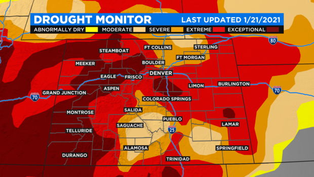
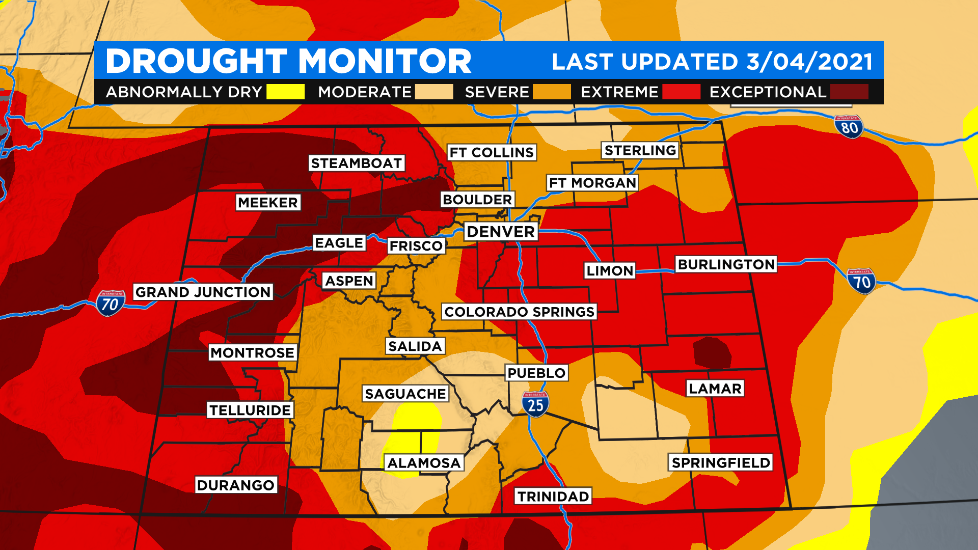
The following two maps shows how drought in Colorado expanded in both coverage and intensity between April 2020 and January 2021.
There has been a little improvement in our drought since January thanks to a cold and snowy February. Parts of the San Luis Valley are actually back into the 'abnormally dry' category which means moving toward drought recovery. But things can slip right back to where they were in a hurry if Mother Nature doesn't keep the rain and snow coming.
This winter season has been dominated by La Niña which is something that happens along the equator in the eastern part of the Pacific Ocean. But there is a teleconnection between the ocean and the atmosphere that causes La Niña to have an influence on weather patterns worldwide. For Colorado that can often mean a quiet storm track with a lot of wind and below normal snow, as we've seen this year.
RELATED: Colorado Statewide Drought Has Denver Water Officials Worried
Stay tuned to see how the approaching weekend storm evolves across the state. Could it be a drought buster? That is a high bar to reach. A very high bar!
Because this storm is so large and will be moving through the state slowly, it has the potential to at least put a nice dent in the widespread drought. It will be exciting to follow as it unfolds later this week.
