Just one week after catastrophic flooding, Pagosa Springs faces an even bigger threat

The flood forecast in southwest Colorado has trended toward a worst-case scenario, with historic flooding expected along the San Juan River in Pagosa Springs.
The river is now forecast to crest at 21.87 feet, nearly 7 feet higher than last week's catastrophic flooding and 4~ feet above the previous record set in 1911. This is expected to be the highest river level on record.
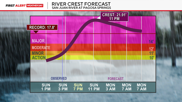
The National Weather Service in Grand Junction says that at 20 feet, some homes become inaccessible as roads flood.
The San Juan River, at Pagosa Springs, is under a particularly dangerous situation flood warning.
Another atmospheric river is sending a surge of Pacific moisture into southwest Colorado. This is having such high impacts because it is happening just over a week after catastrophic flooding. The ground is already saturated, meaning much of this new rainfall has nowhere to go but downhill into rivers.
Another 1 to 3 inches of rain is possible as the storm continues.
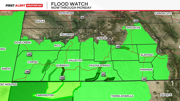
The latest forecast indicates the worst flooding will occur between 6 and 11 p.m. Sunday, with the San Juan River expected to remain in major flood stage through much of Monday morning.
Mandatory evacuation orders remain in place for low-lying areas along the San Juan, Rio Blanco, Navajo and Piedra rivers. Pagosa Springs is closed to incoming traffic.
Officials are also warning that emergency rescues could become extremely difficult as flooding worsens.


