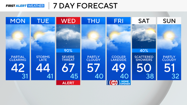
Chilly couple of days before risk of severe weather returns to Chicago area

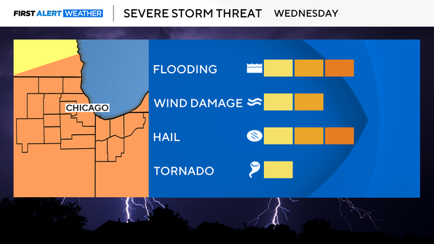
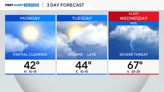
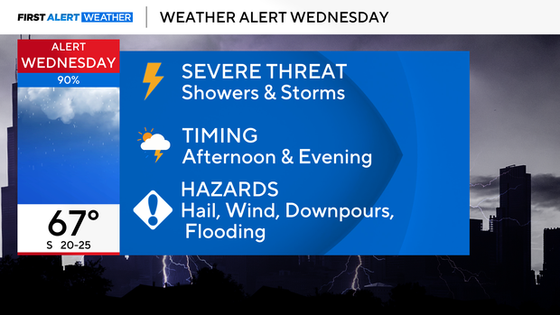
Our next severe storm threat arrives late Tuesday night then again on Wednesday as another spring storm system will sweep across the mid-west.
All of Chicago and Northwest Indiana are already under an enhanced risk, level 3 out of 5, for severe storm potential Wednesday. Tuesday, North and west of Chicago is under a slight risk, 2 out of 5, and a Marginal risk east, level 1 out of 5.
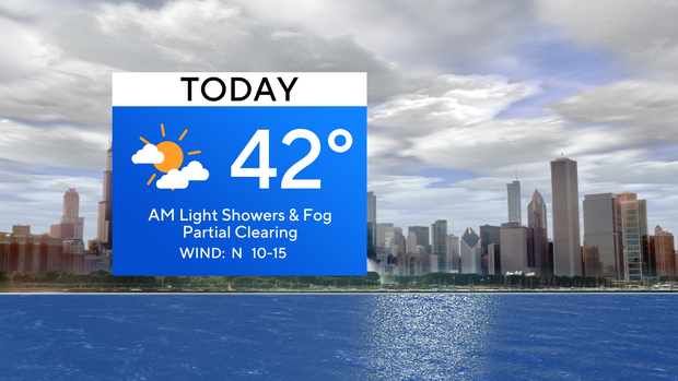
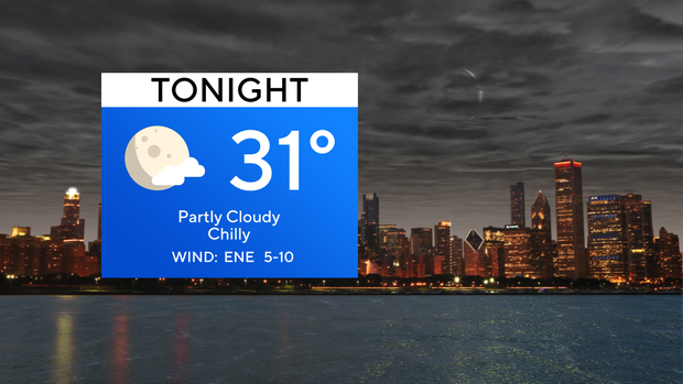
For Monday, expect the rain and fog to diminish by daybreak, and clearing skies are expected for the afternoon. It'll be a chilly day, with highs only topping out in the lower 40s. 30s are expected tonight with partly cloudy skies.
More clouds roll in Tuesday, along with a chance for rain by the evening. Stronger storms are possible Tuesday night, and then more rounds of showers and storms will roll through the area Wednesday.
Wednesday seems to be the most likely day for strong to severe storms, so a weather alert has been posted due to the severe threat. Right now, the timing looks to be the afternoon and evening but stay with your First Alert Weather team for updates.
TODAY: PM clearing, with a high of 42.
TONIGHT: Low of 31, partly cloudy.
TOMORROW: Mostly cloudy, with storms arriving late.