
A Gloomy Stretch...
After days of warm and mostly sunny weather we are now paying the price...three straight days of gloomy weather.
Watch CBS News
After days of warm and mostly sunny weather we are now paying the price...three straight days of gloomy weather.
Our pleasant weather lasts for a little while longer but very shortly humid air returns.
The high in Boston today was 81 degrees...granted it was set in the morning and much of the day was spent in the 70s due to a seabreeze...
Clear, dry air providing ample sunshine can be expected again tomorrow...only with less of a pressure gradient a light seabreeze will develop along the coast.

Irene hit southern New England with Tropical Storm force wind gusts and heavy rain Sunday. Here are the towns hit the hardest.

The final feeder bands of rain from Tropical Storm Irene will spiral into the Boston area in the next couple hours while the steadier, torrential rain exists over northern New England.
The first rain bands out ahead of Irene have arrived and they mean business. Torrential downpours have caused flooded streets, parking lots and even some basements and the storm is still 500 miles away from us!

Irene continues her journey north steadily making progress toward Eastern NC and then up the Mid-Atlantic and into the New England. Irene had a tough time today, despite being over warm water and away from any land she weakened and is now a weaker CAT two hurricane with winds of 100mph
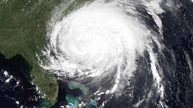
We are becoming more and more confident that New England may be in for its first hurricane in 20 years, since Bob in 1991.
Since last night a favorable shift in the official Hurricane Center track has occurred...that shift puts the projected path of Irene through far Western New England.
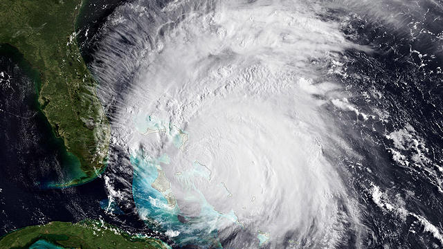
As Category 3 Hurricane Irene continues to churn through the Bahamas, folks along the East Coast are keeping a close eye on the projected path and forecasted strength.
Irene is still four days away yet confidence is growing for a New England landfall sometime on Sunday, most likely in the evening as a decaying hurricane.

In less than 24 hours, Hurricane Irene has grown from a Category 1 to a Category 3 hurricane, what is considered to be a "major" hurricane.
Now to Irene...a little dry air poked intot he center this afternoon and weakened the system ever so slightly but she seems to be overcoming that now and flaring back up with some impressive thunderstorm growth...the next advisory may show this, if not then the one after that.

Sunday appears to be the day of greatest concern here in New England, when the majority of rain and wind would occur from Hurricane Irene.
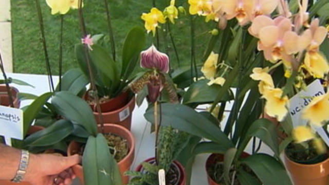
In this week's Gardening With Gutner, Todd and expert Mark Saidnawey discuss how to care for your orchid.
Irene may be down near the Dominican Republic but it is all the weather community is talking about.
The air got increasingly warm and humid thru the day but there wasn't a whole lot of forcing for widespread t-storms but we did have one and it got warned on in Worcester County for wind and hail.
What a day! For sure a top 10 this Summer...the high was 84 just after the noon hour but temps fell back into the upper 70s near the coast due to the seabreeze. Humidity was a non-factor as dewpoints stayed mostly in the 50s...that's about to change.
High temperatures the last two days have been 69 and 72(so far) respectively...and to be honest today felt more like Autumn than Summer.

If you are having trouble growing the perfect garden in your backyard, chances are the problem may lie beneath the surface.
We are looking at this storm as kind of a mini Noreaster...it's got it all, heavy precip, gusty winds and large waves too!

There's a hidden gem on the Cambridge-Watertown line that's home to some of the tallest trees in the state.

For many of us urban gardeners, the shady areas of our garden are often the most challenging, but there are plants
Warmth and humidity are surging back in to Southern New England...this is going to lead to increasing clouds tonight and potential for some late night showers with an approaching warmfront.