Burst of snow in Boston area could impact travel on New Year's Eve after midnight

We'll be ringing in the new year with a round of snowflakes in Massachusetts Wednesday night, and it will certainly be something to keep in mind for any late-night travel amidst the celebrations.
While not a powerful storm system, New Year's Eve is always a tricky night for traveling on local roads. Adding in some snow and slippery roads could compound any issues out there, so please plan accordingly.
When does snow start?
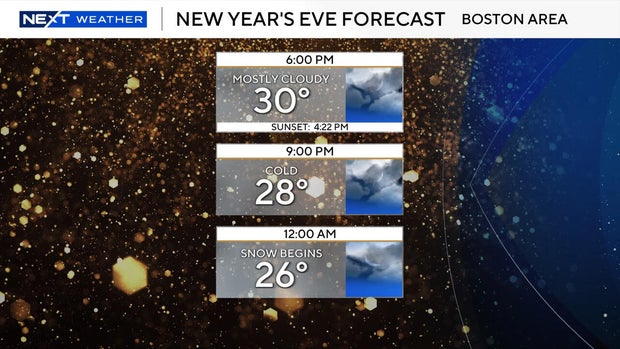
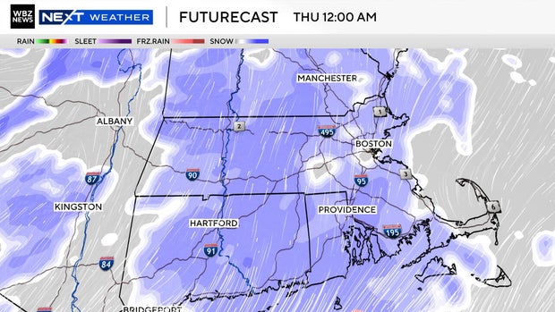
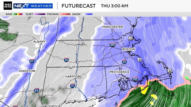
Light snow should start to break out between 10 p.m. and midnight across the Boston area. A burst of heavier and steadier snow is possible just after midnight, especially across southeastern Massachusetts where the highest totals will be expected.
This burst will come to an end by sunrise on New Year's Day, leaving behind some fresh snowy scenes to ring in 2026.
Travel impact
With cold pavement surfaces any snow should stick right away Wednesday night, and with lots of people moving from celebration to celebration it will be important to use extra caution.
Most will not see large snow totals, but slick streets will demand slower travel and some extra focus to get home safely.
How much snow?
Most will end up with just a coating to one inch of new snowfall.

Where some heavier bands are expected, 1-to-3" should fall in southeastern Massachusetts. Cape Cod and the Islands may do best of all with some localized 4" amounts not out of the question.
With some fluff factor, there also may be some localized 2" amounts on the western side of the Worcester Hills