Map shows who will get the most rain in Massachusetts in week of wet weather
This week could end up being one of the wettest of the entire spring and summer in Massachusetts.
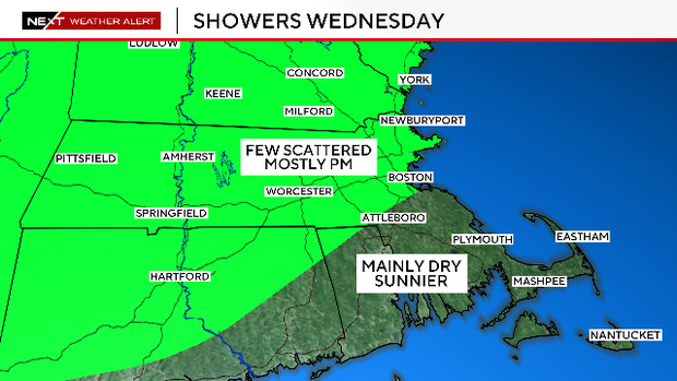
After heavy rain on Tuesday, the Boston area will get a break on Wednesday with a mix of sunshine and building clouds.
There will be a few pop-up showers, mainly in the afternoon and evening, focused primarily from Boston to Worcester and areas northwest.
We do not expect these pop-ups to cause any major disruption or renewed flooding.
Scattered showers Thursday night
After some more sunshine early Thursday, clouds will once again roll in later in the day.
There will be a few scattered showers Thursday night but the main impacts from this next storm system will arrive during Friday morning.
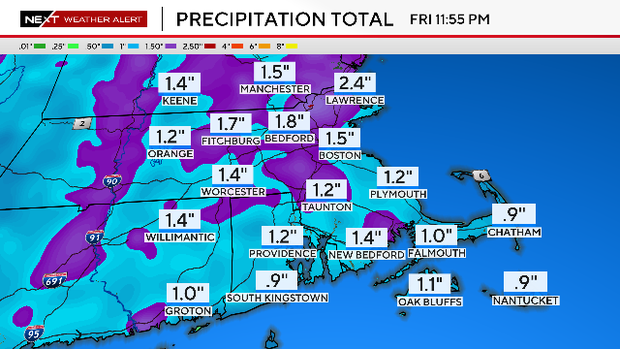
Potential washout Friday
Friday has the look and potential to be a washout with steady rainfall likely for most of the day.
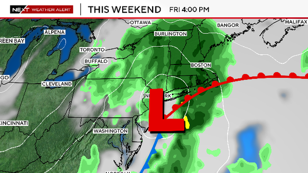
Early estimates are for another 1-2" of water on Friday, leading to another round of localized flooding.
Some rivers and streams may approach their crest levels, particularly across central and western Massachusetts and portions of Connecticut.
Mother's Day Forecast
There will be some leftover cloudiness on Saturday morning, but we expect a mix of sun and clouds during the afternoon.
Winds will be gusty in the wake of the storm, gusting 20-40 mph during the day Saturday.
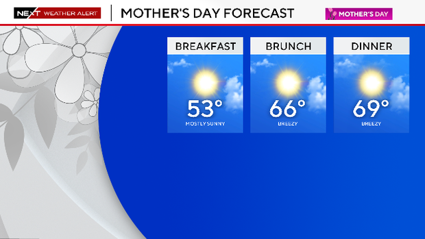
Mother's Day is looking terrific with highs near 70 degrees and tons of sun!


