Nor'easter gradually winding down, will impact Massachusetts through Monday evening

The late September nor'easter will continue to impact Massachusetts through Monday evening. Despite the storm gradually winding down, some minor impacts are still expected from flooding to coastal concerns.
The strongest winds are behind us. There were some locations, especially the higher terrain and at the coast where the wind gusted 50 to 70 mph. Scattered tree damage and power outages were reported. As this coastal storm slowly begins to move away, winds will still be elevated at 20 to 30 mph, with gusts up to 40 mph along the coast overnight.
On Monday, northeast winds in the morning will begin to shift direction to the north-northwest late in the day as the storm pulls away, with a lighter northwesterly wind by Tuesday morning.
Another heavy band of rain
A significant amount of rain fell across parts of the region. While showers have become more scattered Sunday evening, another heavier band of rain is likely to pivot into SNE late Sunday night into Monday morning.
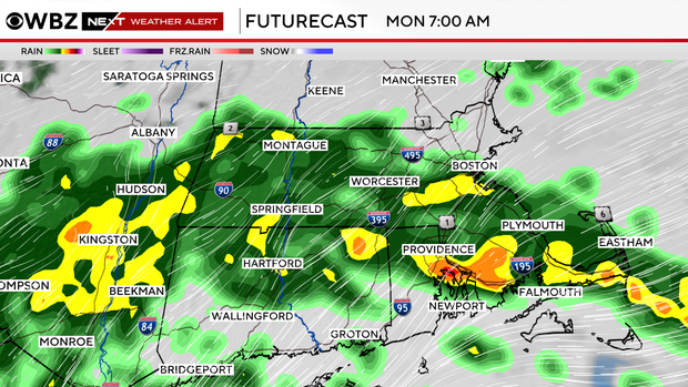
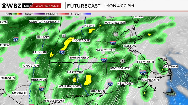
There may be times of limited visibility, ponding on the roadways and areas of minor flooding. Plan extra time for the morning commute and never drive through a flooded roadway. It only takes 12 inches of rushing water to move a vehicle, and you don't know if there is any damage to the roadway under the floodwaters. Rain showers will continue off and on Monday, with the rain beginning to taper Monday night.
Flood Watch through Tuesday
A Flood Watch remains in effect for all of eastern Massachusetts through Tuesday morning, as an additional 1 to 3 inches of rain is possible.
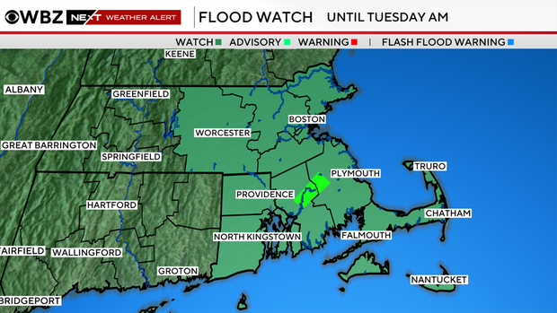
Not only is there the potential of street and urban flooding, but small rivers and streams also may flood over their banks. There is currently a Flood Warning in effect for the Taunton River near Bridgewater through Tuesday evening.
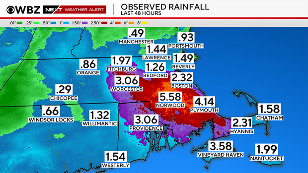
Coastal impacts diminish
Coastal impacts will continue to diminish Sunday night through Monday. The risk of moderate coastal flooding has ended. However, there still could be some nuisance coastal flooding along the south coast and minor coastal flooding along the eastern coast at times of high tide over the next 24 hours, and splashover until this storm pulls away and winds turn out of the northeast.
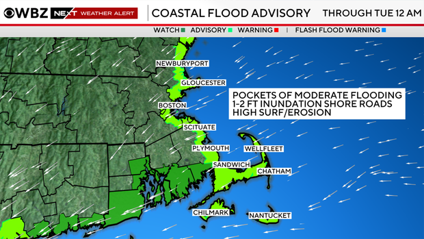
Minor beach erosion is still possible. Afternoon tides are still running astronomically high due to the full Harvest Moon both Monday and Tuesday.
Seas will also begin to lower as the nor'easter pulls away, but inexperienced mariners and small vessels are encouraged to stay docked on Monday as rough seas and gusty winds are still likely. A Gale Warning and Small Craft Advisory are in effect until Monday afternoon.
Warmer weather ahead
As this nor'easter pulls away, it will dry out Tuesday with mostly cloudy skies. It will continue to turn brighter and warmer throughout the week.
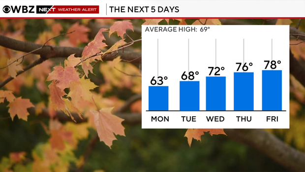
There may be some areas that push near 80 by Friday, before it may turn unsettled again by next weekend. Stay with the WBZ Next Weather Team for updates to the forecast.


