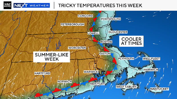
Some parts of Massachusetts will get a taste of summer weather this week. Map shows where temperatures could top 80.
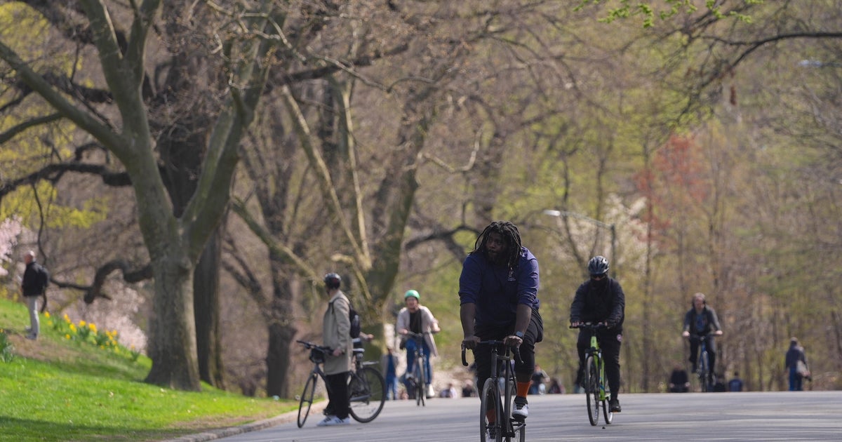
Many people in Massachusetts will be getting their first real taste of summer this week. While temperatures have largely been above average since the beginning of March, there haven't been many real warm days. Boston has had just two days in the 70s thus far and inland locations (away from sea breezes) a few more.
As usual, widespread and prolonged summer-like weather is very hard to come by this time of year around here. You can blame the ocean. The thing that draws so many folks to New England and gives us such joy in the summertime can be an absolute party-pooper in the spring.
While the rest of the country heats up so quickly and easily, there is a battle going on in New England. In short, it is nearly impossible to get a day in April where everyone is in the 70s or 80s. If the winds blow from the south or southwest, the South Coast and Cape Cod get the cold, ocean air. If the winds blow from the east, forget it, we are lucky to get out of the 40s. If the winds don't blow or are light, sea breezes develop, stunting any warming, especially close to the coast.
This week is definitely going to be one of those weeks. Sea breezes, backdoor cold fronts, periods of marine air-induced low clouds and fog, and on top of that, a daily shower and storm threat. Yet, for a large portion of Massachusetts, this will be the warmest week yet.
Let's go day by day:
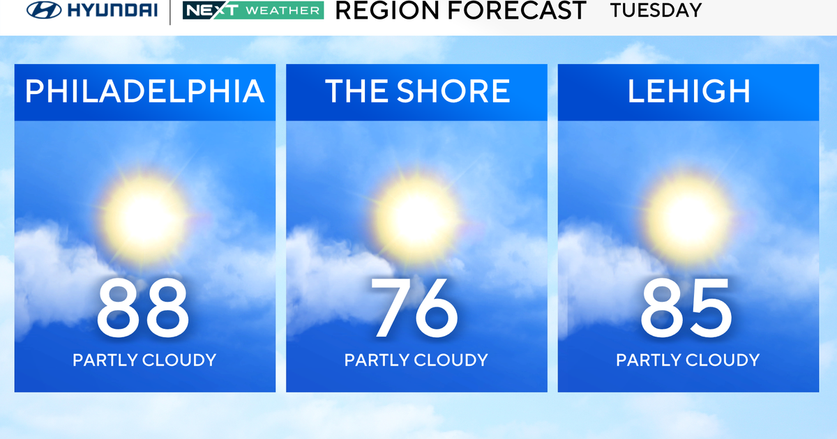
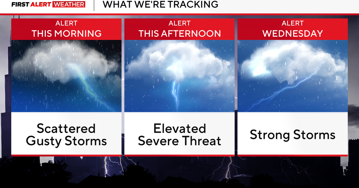
Tuesday
The warmest day of the week overall with several inland towns topping 80 degrees.
A south-southeast wind will keep the South Coast and Cape and Islands in the 50s and 60s.
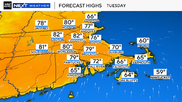
Along the east coast, temperatures will warm to 70 or a bit higher before dropping back in the afternoon.
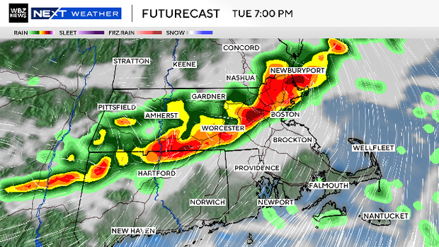
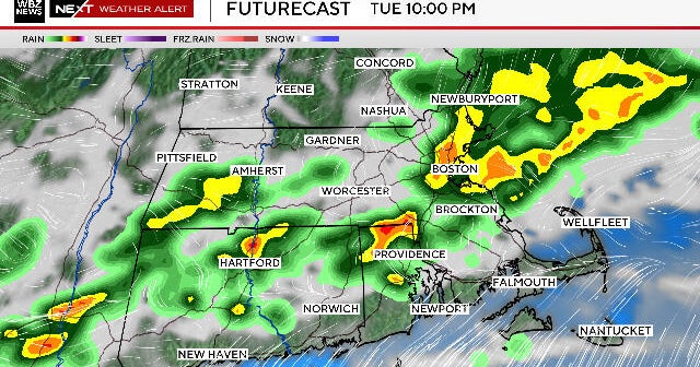
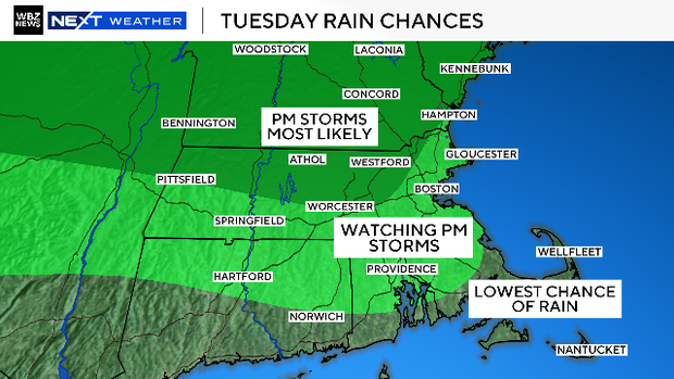
Tuesday also brings a decent shot of some late day showers and thunderstorms. Watch out between 4 p.m. and 10 p.m. for some heavy downpours and perhaps, a few isolated severe thunderstorms.
Wednesday
There will be more clouds around Wednesday than Tuesday so temperatures will not be not as high.
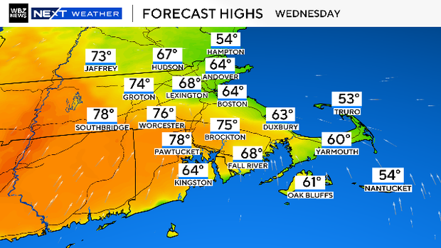
We could still reach the mid to upper 70s west of Route 495, but areas inside of 495 and 95 look to be stuck in the 60s.
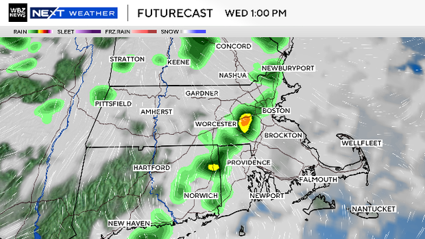
There is also a chance of an isolated shower or storm here and there, but likely nothing quite as organized or strong as Tuesday.
Thursday and Friday
Generally, the end of the week looks much the same. The best chance of warmer temperatures (70s and 80s) is inland, with a fairly high risk of cooler, onshore winds in eastern Massachusetts.
Also, both days carry a slight risk of a passing shower or storm.
The weekend
At this point, it looks like temperatures will be much cooler across Massachusetts by this weekend.
Saturday will almost certainly be a cooler day with lots of low clouds and temperatures stuck in the 50s.

Sunday has a chance of being warmer, but it all depends on the timing of a cold front.
Boston Marathon weather forecast
Monday looks like the coldest day of the entire forecast for the Boston Marathon.

Currently, we are forecasting mid-to-upper 40s for high temperatures with a very gusty, westerly wind making it feel like the 30s.