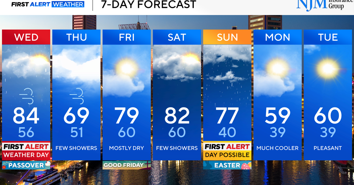
Damaging winds cause power outages in parts of Massachusetts
Very gusty winds caused scattered tree damage and power outages across Massachusetts Tuesday.
The National Weather Service issued a High Wind Warning for elevated areas including Worcester County for possible gusts to 60 miles per hour.
Across the rest of southern New England, there is a wind advisory for gusts as high as 50 mph.
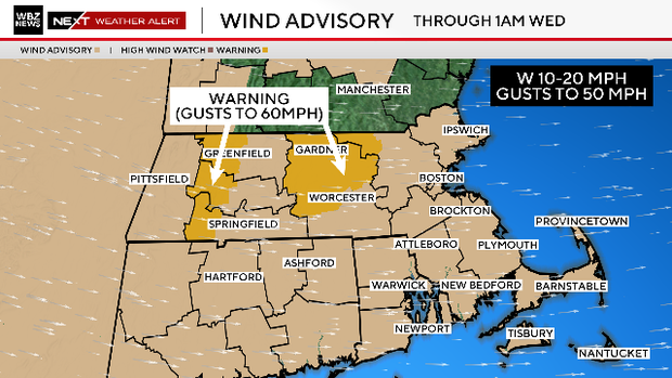
We will see peak gusts topping 50 mph Tuesday through the afternoon. More than 3,000 homes and businesses had lost power as of early Tuesday afternoon, according to the Massachusetts Emergency Management Agency (MEMA).

The wind chills will be in the single digits and they will stay there for most of the day. Any standing water left over from Monday's rain and melting snow has frozen again, so use caution outside.
The rest of the week will be quite cold. Temperatures will remain below average for the foreseeable future. This includes New Years Eve and New Years Day.