Plowable snow in forecast Tuesday for Massachusetts. Maps show timing and how much Boston could get.
Before we start the "great snow melt of 2026," there is another storm system in the weather forecast for the Boston area.
A fast moving clipper system is going to sweep through New England Tuesday evening, bringing with it a brief round of snowfall.
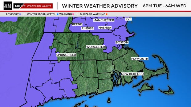
The National Weather Service has issued a Winter Weather Advisory for New Hampshire, Vermont, Maine and parts of Massachusetts.
When does snow arrive?
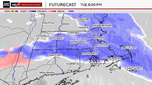
The snow arrives in eastern Massachusetts between 4 p.m. and 6 p.m. Tuesday, just in time for the evening commute in the Boston area.
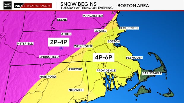
There could be a pretty significant burst of snow as it arrives, leading to roads becoming snow-covered rather quickly.
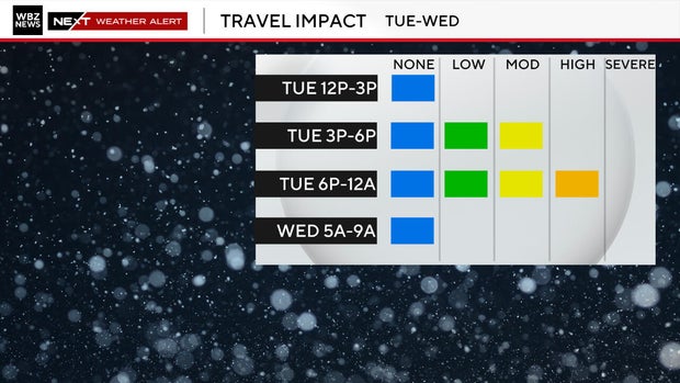
The steadiest snow will occur from 5 p.m. through about midnight. We are watching for some banding which may lead to slightly higher snow amounts in localized areas.
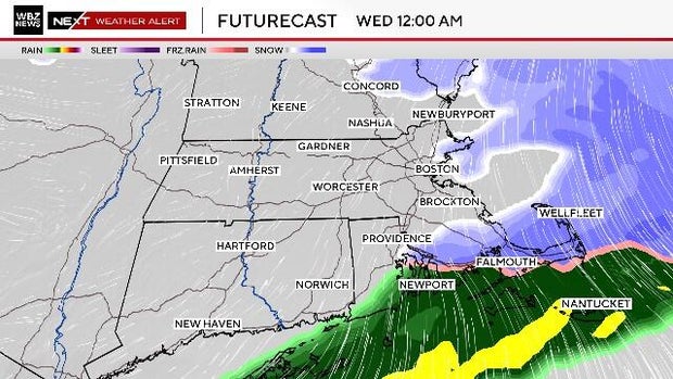
The snow will exit eastern Massachusetts around or just after midnight, ending as a little rain/snow mix over the South Coast, Cape Cod and the Islands.
How much snow will we get?
We expect between 2 and 4 inches of snow in most of southern New England. Slightly lower amounts (coating to 2") over far southeastern Massachusetts.
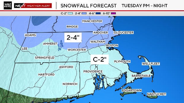
This is certainly enough to plow, shovel and snow-blow.
Milder temperatures ahead
Once the snow exits, we can turn our focus to milder days and melting some of our extensive snowpack.
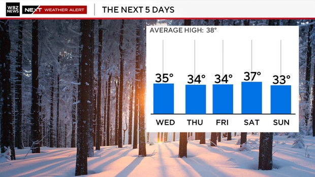
While there isn't a huge warmup coming just yet, high temperatures will be above freezing each and every day this week including Wednesday when we may reach 40 degrees for the first time since January 22nd.
Areas exposed to direct sunlight could lose as much as half of their snowpack by this weekend.