Temperatures drop, sleet and snow return to Boston area Thursday evening. Maps show timing of weather forecast.
The winter weather is not over in Massachusetts. Some snow is on the way for the afternoon and evening Thursday and it could create some headaches during the commute in the Boston area.
Temperatures started the day in the upper 50s and low 60s but they're falling with each passing hour.
During the afternoon we will see rain showers across central and eastern Massachusetts. As temperatures continue to drop, the rain will change to a wet snow.
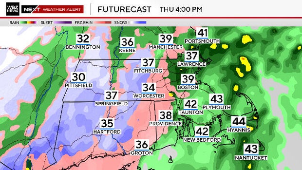
By 4 to 5 p.m., it will be sleeting or snowing near and west of Route 495 including most of Worcester County.
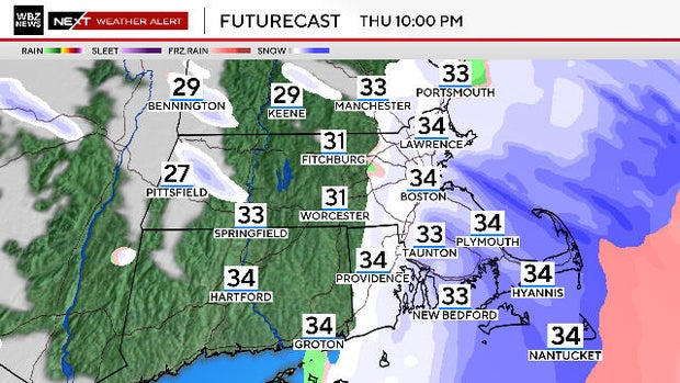
Between 5 and 7 p.m. the rain will change to sleet across eastern Massachusetts and to snow in all areas west of Interstate 95.
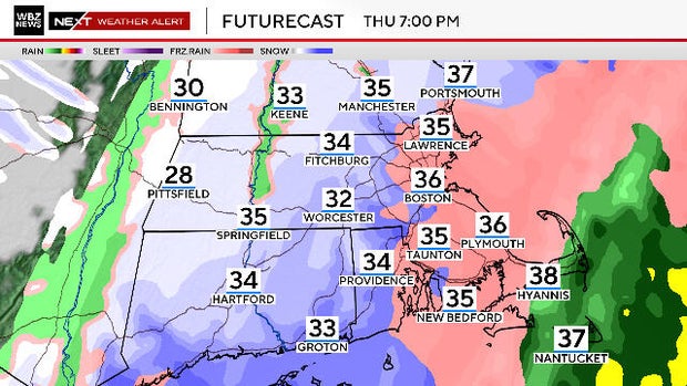
Shortly thereafter, the snow makes it all the way to the coastline. Thankfully, it will taper off rather quickly, coming to an end between 9 p.m. and midnight from west to east across Massachusetts.
There's no need for a detailed snowfall accumulation map with this event. Essentially, just about everyone will see some snowfall and there will be scattered coatings of sleet and snow throughout the area.
The best chance of up to an inch of accumulation would be on the grass and in the typically colder locations.
Some roads will become slippery but we do not expect too many issues on the main, well-traveled roads.
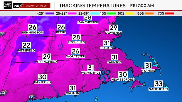
Overnight, the entire region drops below freezing. Therefore, any leftover water on untreated surfaces will ice up.
If you are heading out late tonight or early Friday morning, watch that first step.