Heavy rain, damaging winds possible starting Monday in Massachusetts

The Boston area and much of southern New England is heading into an active stretch of weather to start the week, with periods of heavy rain, embedded thunderstorms, and strong winds expected, especially Monday night.
The system will tap into an unusually moisture-rich air mass for mid-March, which could lead to localized flooding and potentially damaging wind gusts in parts of the region.
Massachusetts flooding threat
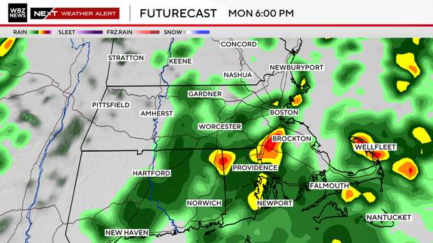
Rain will begin increasing Monday and may fall steadily at times through Monday night.
Forecast guidance continues to show above-normal moisture levels associated with this storm.
Atmospheric moisture is called precipitable water, and values could approach 1.5 inches, which is very high for this time of year for this area.
That moisture combined with strong storm dynamics could produce widespread rainfall totals near 2 inches across much of southern New England.
In some areas, especially where thunderstorms develop, localized totals could approach 3 inches.
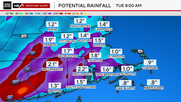
Because rivers and streams are already running above normal from recent snowmelt and rain, this additional rainfall could cause:
- Small stream and river flooding
- Water ponding on roads
- Urban and poor-drainage flooding
The risk will be highest Monday evening into Monday night when rainfall rates may briefly intensify.
Damaging winds
While winds will begin increasing Monday afternoon, the most impactful wind potential arrives Monday night.
A powerful low-level jet, essentially a fast river of air a few thousand feet above the ground, will sweep across southern New England ahead of a cold front.
Some forecast models suggest winds of 90–100 mph about 3,000 feet above the surface, particularly near the southeast New England coastline.
The big question will be how much of that wind mixes down to the surface.
Even if only about half of those winds reach the ground, gusts could still reach:
- 45–55 mph across much of southern New England
- 60 mph or higher across eastern Massachusetts and Rhode Island
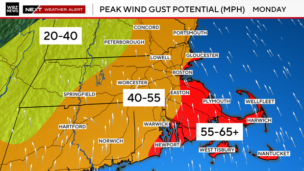
These stronger winds could bring:
- Isolated tree damage
- Power outages
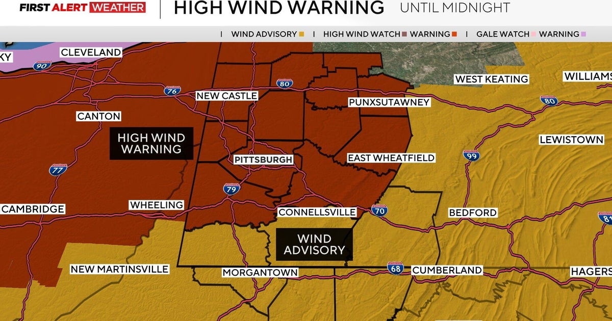
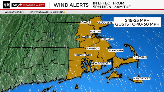
A High Wind Watch is already in place for eastern Massachusetts and Rhode Island Monday evening through early Tuesday morning.
Thunderstorms possible in Boston area
Some forecast models also suggest a narrow line of thunderstorms developing along the cold front Monday night.
Even though the atmosphere will only be marginally unstable, that line of storms could act like a conveyor belt to help pull stronger winds down to the surface.
If that happens, localized damaging wind gusts are possible.
Right now, the severe weather risk appears low overall, but strong wind gusts remain the primary concern
Colder air returns Tuesday
Behind the storm, much colder and drier air rushes back into the region Tuesday.
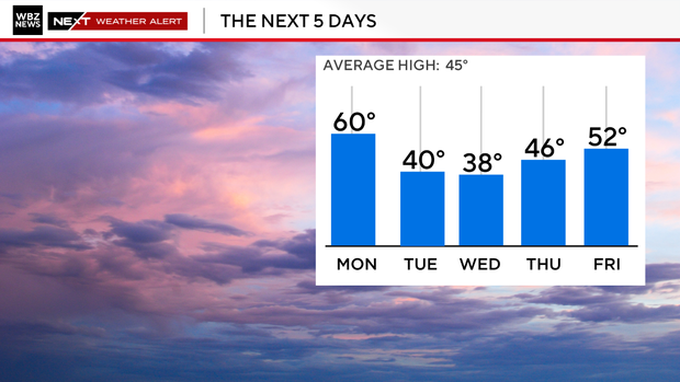
- Tuesday: Blustery with afternoon temperatures in the 30s. (Southern New England hits its high for the day at midnight)
- Wind gusts: 25–35 mph
- Tuesday night: Lows drop into the teens and lower 20s
Wednesday stays chilly, but winds will ease as high pressure builds in.
Temperatures should begin moderating again late week, with highs returning to the upper 40s and low 50s by Friday.
Severe weather in southeastern United States
Before this storm reaches southern New England, it is expected to produce a significant severe weather outbreak across parts of the southeast and Mid-Atlantic on Monday.
The Storm Prediction Center has issued a Moderate Risk for severe thunderstorms from northern South Carolina through North Carolina into Virginia and Maryland, signaling the potential for a widespread severe weather event.
Storms developing Monday afternoon could bring:
- Tornadoes, some potentially strong
- Widespread damaging wind gusts
- Fast moving severe thunderstorm lines
Some storms may move over 50 mph, which increases the risk for long track tornadoes and widespread wind damage.
By the time the storm reaches southern New England, the tornado threat drops off, but the system will still pack a punch with heavy rain and strong winds Monday night.