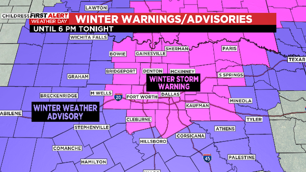
Winter Storm Warning Still In Effect As Freezing Drizzle Moves Out Of North Texas
NORTH TEXAS (CBSDFW.COM) — On this First Alert Weather Day CBS 11 Meteorologists are watching the morning icing event that is moving to the east, expecting the trend to continue through the afternoon.
The threat of black ice will continue to make for dangerous travel overnight and across the morning commute Friday.
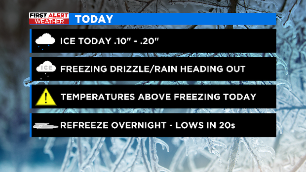
Areas of the Metroplex were hit with .10"-.20" of ice this morning. That precipitation fell on top of some minor icing that had occurred overnight on bridges, overpasses and secondary roads. Some roads started to improve by late morning.
What will help this afternoon is when temperatures drift up just above freezing and (hopefully) we get a few peeks of sunshine. If this happens we'll all enjoy a respite from the ice problems of morning.
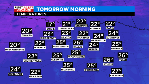
As we fall into the evening however, any road that isn't cleared of all ice/water will refreeze. Lows are expected to be in the low 20s by Friday morning.
Highs are expected to climb into the mid 40s. By Friday night however in comes another rain event. The good news about this is the freezing line will be north of the rain event. That means it will be a cold rain on Saturday, but the rain will help wash away all the sand, salt and the last of the morning ice.
All of this will be a distant memory by the time we get to the start of meteorological spring (March 1st). Highs will be in the low 70s with mostly sunny skies.