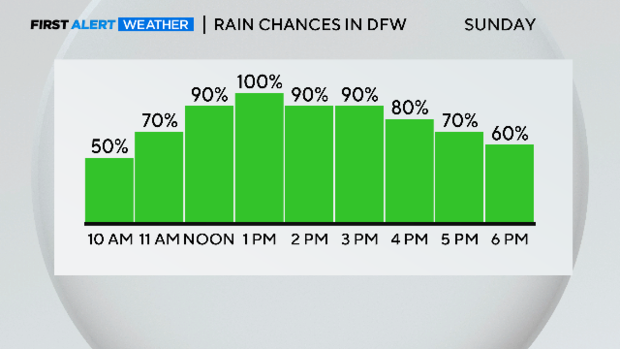
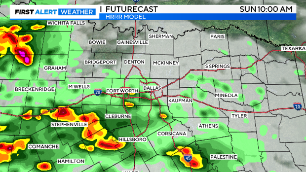
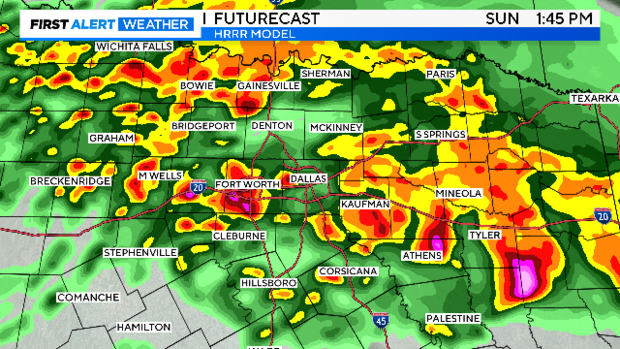
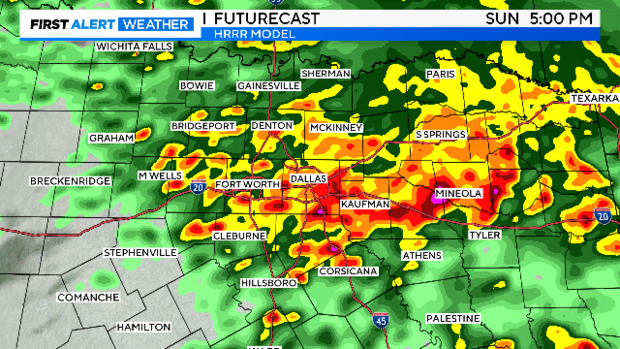
Widespread heavy rain, non-severe storms Sunday in North Texas
NORTH TEXAS – The First Alert Weather Team continues to track rain and thunderstorms moving across North Texas.
A Flood Watch remains in effect until 1 p.m. Monday for areas south of I-20 as well as Dallas and Rockwall counties.

Any severe storms have stayed to our south in Central Texas today, where there have been several reports of golf ball size hail.
The severe threat is low in our area for the rest of the day, but flooding is a concern.
A Flood Advisory has been issued for Wise & Denton counties until 2:30 p.m., where 1"-2" of rain have already fallen.


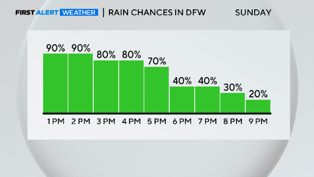
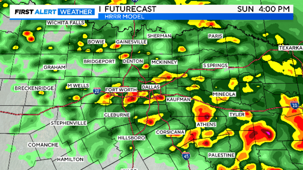
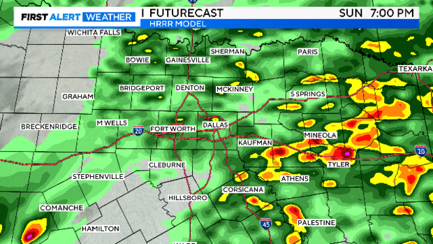
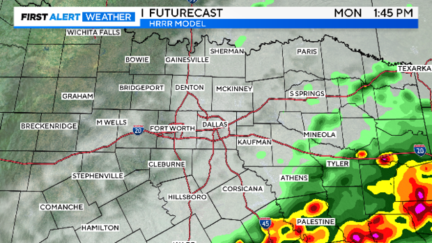
Rain and thunderstorms will continue to track northeast across the area into the evening hours.
Even though the severe threat is low, an isolated strong to severe storm capable of gusty winds and hail, can't be ruled out.
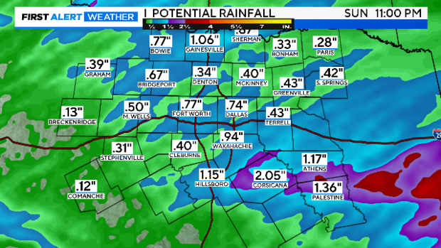
An additional 1"-3" of rain is possible, please watch for localized flooding and ponding on roadways.
Remember: Turn Around, Don't Drown. Never try to drive through water covered roadways.
The clouds and rain will hold temperatures fairly steady the rest of the day.
Most areas won't make it out of the upper 60s on this Mother's Day.

A few strong to severe storms are possible tomorrow as a cold front slides through North Texas.
Then we enjoy sunshine for Tuesday and Wednesday with temperatures back in the mid- to upper-80s.
Our next round of widespread rain and storms arrives late Wednesday into Thursday.

Stay dry!
=====
ORIGINAL FORECAST
NORTH TEXAS – Happy Mother's Day! Keep the rain gear handy as you are out celebrating Mom today.
A Flood Watch is in effect until 1 p.m. Monday for areas south of I-20, including Dallas County. Widespread 2"-3" rainfall totals are expected with isolated totals to 4".
The ground is already saturated in this area, and it won't take much for localized flooding.

We are off to a dry start but that will change over the next couple of hours. Rain and storms have already developed in Central Texas and are tracking Northeast.
The severe threat is low Sunday with localized flooding the main concern.
But we can't completely rule out an isolated strong to marginally severe storm with small hail and gusty winds.

Not only do we have a soggy day ahead, but also a cool one. Temperatures will top out near 70.

On Monday, a cold front will slide through North Texas bringing a few more showers and storms during the morning hours.
An isolated severe storm is possible in North Texas, but the higher chance of any severe storms is to the southeast in the afternoon hours.

Skies will clear Monday evening and remain that way into our Tuesday!
Most of Wednesday is looking warm and dry with our next front arriving overnight into Thursday returning rain to the area.

Have a very Happy Mother's Day!