Workweek starts less humid as triple-digit heat returns to North Texas

Lower humidity Monday has helped heat index values stay below heat advisory criteria, but a southerly wind overnight into Tuesday will increase humidity and push heat index values between 105 and 110° on Thursday and Friday, with heat advisories likely later this week.
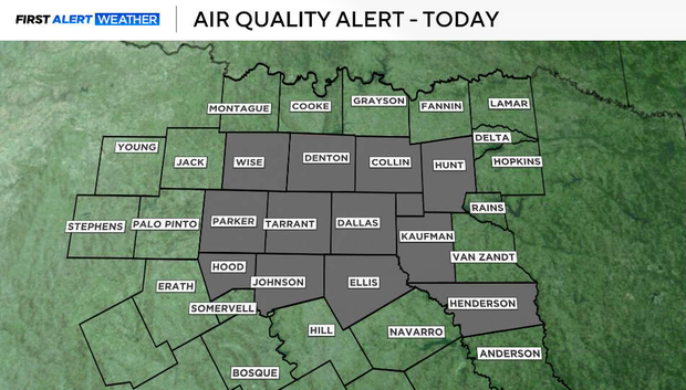
An Air Quality Alert continues Monday afternoon. Heading into the overnight hours, we will keep a south wind that will continue to increase moisture levels throughout the week. Overnight lows won't cool much, and most of North Texas should be in the mid to upper 70s by Tuesday morning.
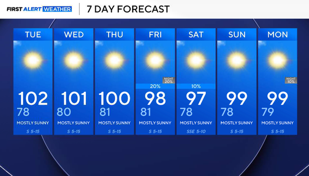
Over the next couple of days, temperatures will be between 100 and 102° for most of the area.
Tuesday will be the hottest day this week, but heat index temperatures will stay up to par with actual air temperatures, so it won't feel oppressively hot thanks to slow moisture returns over the area. Moisture will build throughout the week, though, with heat index values creeping up between 105-110°F as early as Thursday, where we will monitor the potential for a heat advisory that day.
There will be minimal cloud cover over the next couple of days, with overnight lows in the low 80s, making for very warm morning temperatures.
Friday into Saturday, the ridge of high pressure will move far enough to the west to bring a small upper-level disturbance into our region, and with enough moisture, we will reintroduce a 10-20% chance of isolated showers Friday overnight into early Saturday.
We're not expecting anything significant, but we could keep our daytime temperatures in the upper 90s through the weekend.