More freezing rain is in store for Wednesday
NORTH TEXAS (CBSDFW.COM) - Our stretch of First Alert Weather Days continues Wednesday and if we're being honest, Wednesday is likely going to be worse than what we saw Monday and Tuesday.
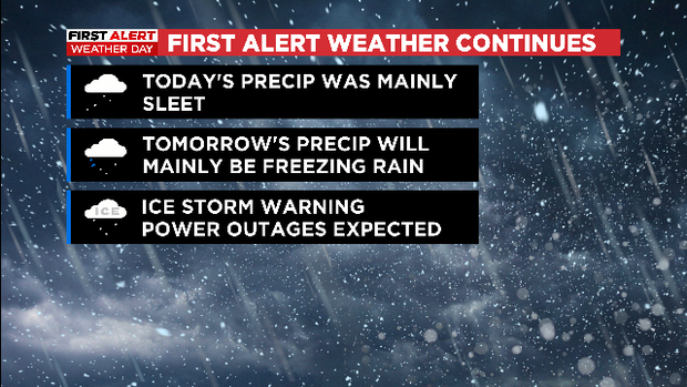
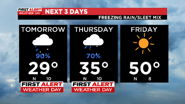
Sleet was the main precipitation we saw on Tuesday. And while the sleet certainly caused issued for us, it actually is slightly easier to travel on because the pellets provide a little bit of traction – certainly when compared to ice. The problem with Wednesday's forecast is the main precip we are expecting is freezing rain, aka ice accumulations.
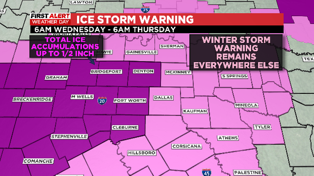
In fact, an Ice Storm Warning is going into effect Wednesday morning for parts of North Texas and will continue into Thursday morning. In this area, ice accumulations up to a half inch are possible. Not only will this lead to dangerous travel conditions on the roads, but the ice accumulation will likely lead to power outages. The ice will accumulate on tree branches, causing the branches to sag, break and impact the power lines.
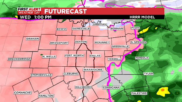
On and off patchy freezing rain and freezing drizzle are expected overnight and into Wednesday morning, but by midday we are expecting widespread freezing rain to overtake the area.
Thursday morning will still feature some freezing rain but afternoon temperatures are expected to warm above freezing and this system is finally expected to move east of us. So, by Friday it will be sunny and highs will warm into the 50s. Sunshine and 60s are expected by Sunday.