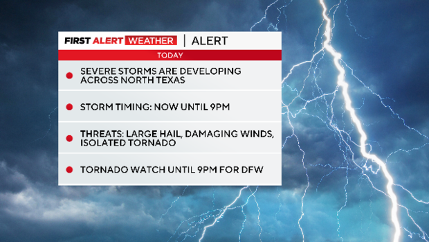
Severe thunderstorm watch issued for parts of North Texas Thursday
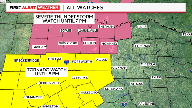
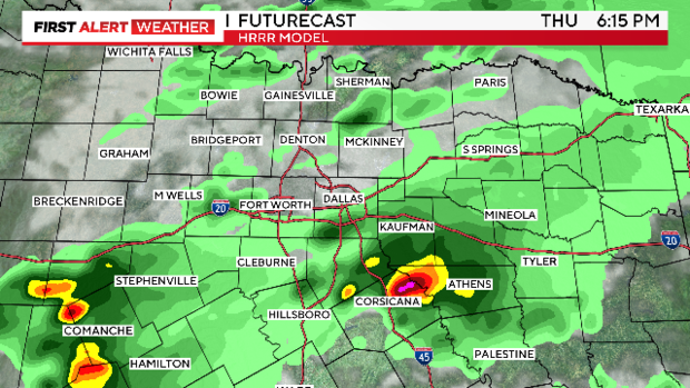
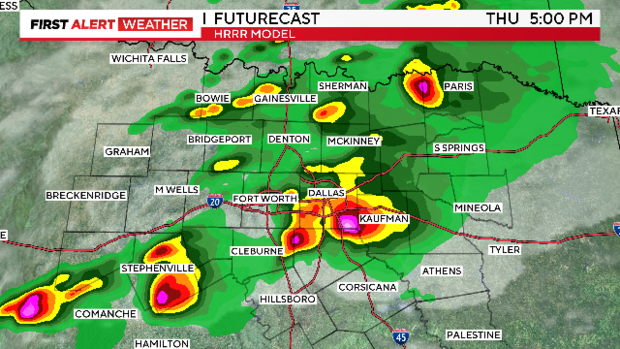
UPDATE 2:30 p.m. — A Tornado Watch has been issued until 9 p.m. for areas along and south of I-20 including Tarrant and Dallas counties.
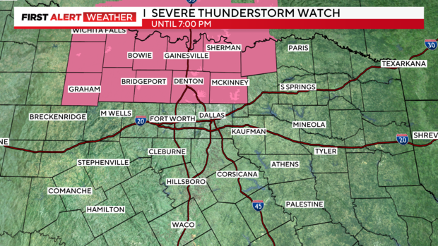
A Severe Thunderstorm Watch remains in effect until 7 p.m. for our northern counties.
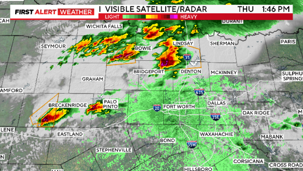
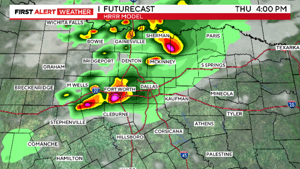
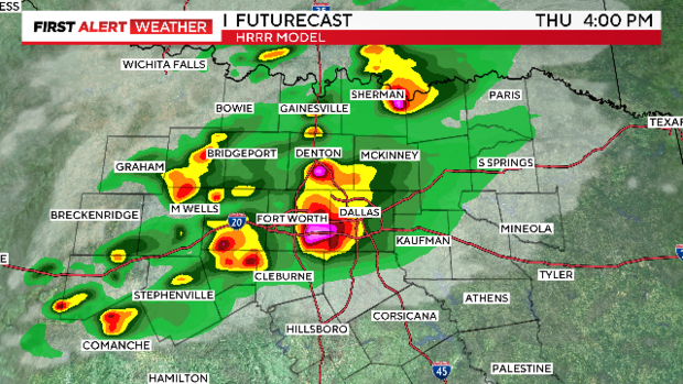
Severe storms have continued to fire up in the northwest counties producing large hail to the size of ping pong balls.
Large hail to the size of eggs will continue to be the main threat for storms that develop in the Severe Thunderstorm Watch.
Large hail, damaging winds and even a tornado are possible for the counties under a Tornado Watch.
Storms will continue to develop through the afternoon and evening hours.
Storms will come to an end shortly after sunset.
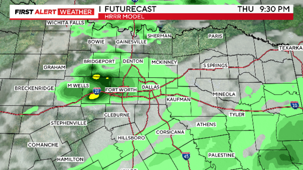
Please remain weather-aware into the evening hours.
Not everyone will experience the severe storms, but those that do will be greatly impacted.
UPDATE 12:30 p.m.: A severe thunderstorm has been issued for counties north of I-20 until 7 p.m., including Collin and Denton counties.
Large hail to the size of eggs and damaging wind winds to 70 mph are possible.
Severe storms have already developed in Young and Jack counties with a history of golf ball size hail.
Coverage of storms will continue to increase through the afternoon hours.
NORTH TEXAS — Thursday is a weather alert day; severe storms are possible.
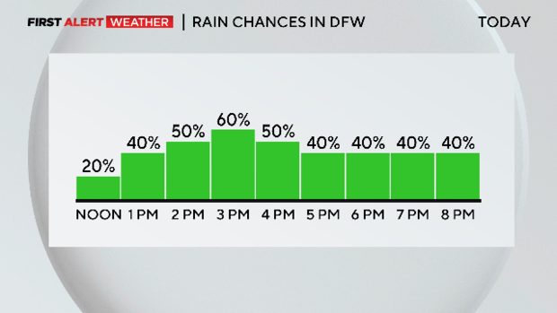
As we move through this Thursday, stay weather-aware. We're tracking scattered showers and storms this afternoon and evening as a front remains stationary near North Texas.
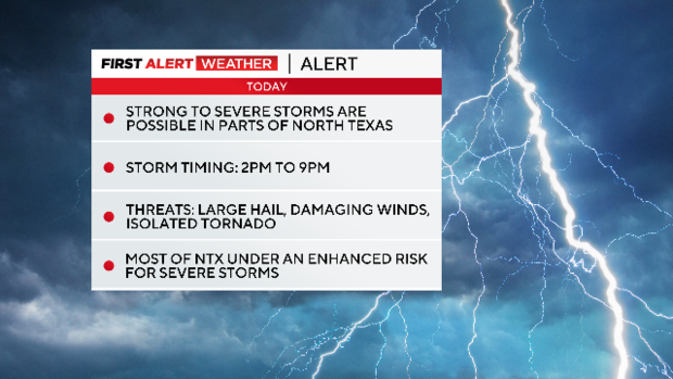
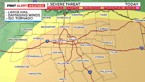
Some storms could be strong to severe. Storms will likely impact the metroplex between 2 p.m. and 9 p.m.
The main weather threats are large hail, damaging winds and an isolated tornado or two. Some localized flooding is also possible.
Otherwise, there will be mostly cloudy skies and high temperatures in the low 80s. Thursday night, lows will be in the lower 60s under partly cloudy skies.
On Friday, we'll see a mix of sun and clouds. Highs will be near 80.
We're not expecting a weekend washout. In fact, on Saturday, we'll see partly sunny skies. A late-day shower is possible, with highs in the upper 70s.
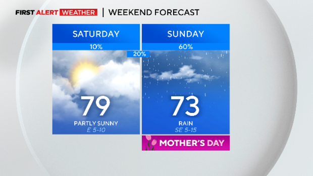
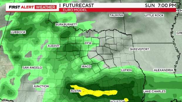
Grab your umbrella for Mother's Day this Sunday. We're tracking scattered rain through the day. An isolated storm is possible, but the threat of severe weather remains low at this time. Highs will be in the lower 70s.
Storms will stick around for Monday. Highs will be in the low 80s.