Warm, windy end to the work week in North Texas before severe weather returns

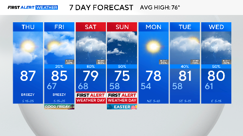
Thursday and Friday across North Texas, it's just about the wind and warm weather.
Temperatures will be in the 80s both days with high humidity. Storms could start showing up in western counties by late afternoon and evening Friday.
Overnight into Saturday, rain and storms will move into the Metroplex. Several rounds are expected through Easter Sunday morning, prompting First Alert Weather Days.
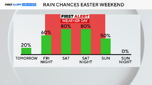
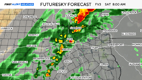
Saturday has the highest severe weather threat with damaging winds and large hail possible. Saturday morning will likely have this activity already going on, with the severe threat increasing by afternoon. The severe threat continues into Saturday evening.
Overnight into Sunday morning, a large line of storms will move in from the west just ahead of a cold front. The severe threat lessens, but the flooding threat increases. Be cautious if you are leaving the house early for sunrise services on Sunday, as urban flooding could be in progress, making for dangerous driving conditions.
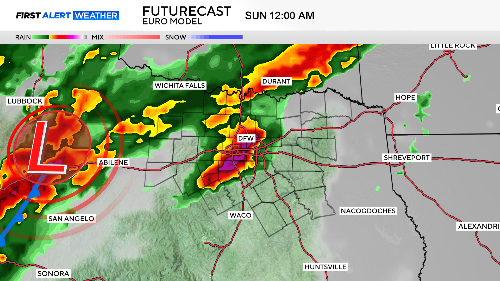
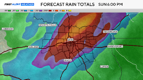
These storms will move to the east by late morning, skies will clear and make for a very nice Sunday afternoon. Rainfall amounts for the entire event Friday night through Sunday morning look impressive, as some areas could get 2"-3" of rain.
Monday looks like a nice day, but rain and storms come right back in for Tuesday and the rest of the week. This is North Texas' storm season, and it is going to start acting like it.