Late Sunday Update Has Sally Moving More East Toward Mississippi
(CBSDFW.COM) - As of late Sunday night Tropical Storm Sally was still packing 60 mph winds but showing signs of getting stronger. The latest forecast showed Sally slowing down and turning more north as it approached the Louisiana coastline.

The various forecast track models used by the National Hurricane Center continue to favor a more eastern track of the storm as it draws closer to shore. Here are some of those track predictions overlaid on the official "cone of uncertainty" issued by the NHC:
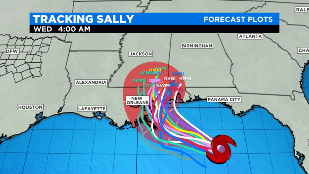
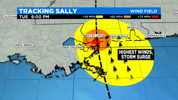
With this new track information in mind this puts the "dirty side' of the storm well east of New Orleans. The dirty side of the storm you ask? The half of the storm that falls east of the center: it has onshore winds plus the momentum of the storm itself that produces higher winds and higher storm surge. Mississippi and Alabama would get the more destructive parts of Sally.
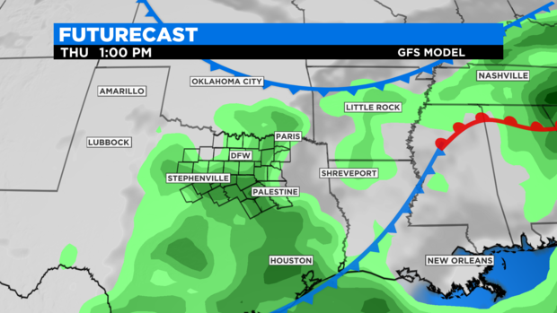
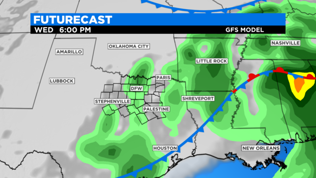
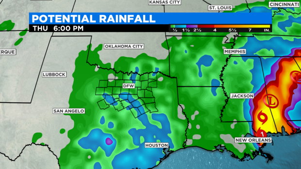
While flooding rains are expected Mississippi, Alabama, and Florida that exceed 12", North Texas should get some of this rain, as well. Sally will wrap around a very deep pool of tropical moisture into Texas. By Wednesday and Thursday that should translate to some decent rain chances for us. Some areas could get over 1" of rain.