Sweater weather! Season's strongest cold front slides through North Texas
NORTH TEXAS (CBSDFW.COM) - We're tracking some huge changes in our forecast so get your warm clothes ready.
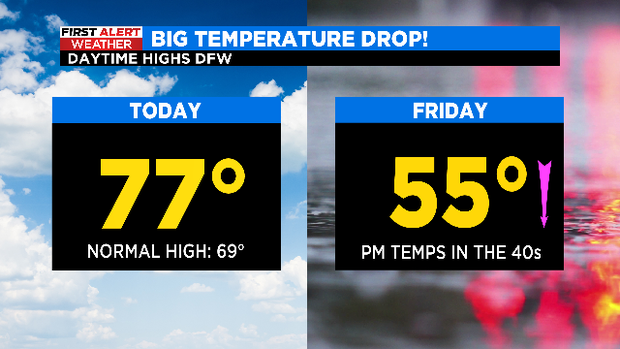
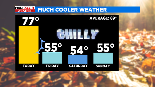
The changes are coming with a cold front. Thursday, ahead of the front, highs will be in the mid to upper 70s. As the front slides through the area late tonight, we'll have a chance of rain and isolated storms overnight into Friday morning. The threat for severe weather is low at this time.

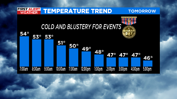
On Friday, as the front slides through North Texas, our temperatures will fall through the day. High temperatures will happen during the morning. Highs will be in the mid 50s. Then, by afternoon, our temperatures will fall into the 40s. With a stiff wind from the north between 10 and 20 mph, it will create feels-like temperatures in the 30s for several communities.
Again, the threat for severe weather on Friday is low for now.
Once we push into the weekend, the cooler weather will stick around. Highs will be in the mid 50s Saturday and Sunday with low temperatures in the mid 30s.
Another front arrives Monday, giving way to a cold rain in the viewing area. Highs will be in the upper 40s.
It looks like the cooler weather will stick around North Texas for the next 10+ days.