Ready For A Weather Whiplash? North Texas Begins Gradual Thawing Out Process
- Warming Centers In North Texas
- Upload Weather Pictures/Video
- School Closures/Delays
- Oncor Outage Map
- Free Firewood Delivery
- List Of Boil Water Notices In North Texas
- List Of Places Giving Away Drinking Water In North Texas
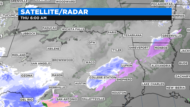
NORTH TEXAS (CBSDFW.COM) - After a long, challenging stretch of winter weather, North Texas begins the gradual thawing out process starting Thursday and Friday. Clouds slowly decrease over the next 24 hours, allowing for some welcomed-sunshine, followed by the melting of snow cover and ice throughout the region.
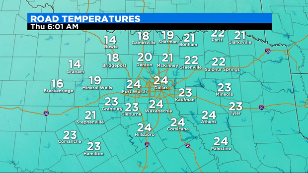
The one issue here -- we'll be below freezing each morning until Sunday morning when temperatures are slightly warmer. This means that we'll experience partial-melting each day followed by refreezing at night, so the black ice threat stays high now through most of the weekend.
By the end of the weekend, a major pattern change is unfolding as the historically cold air mass returns north and southerly flow builds in for the western half of the country.
As high pressure starts to settle in, we see the return of sunny days with drastically warmer, near average temperatures.
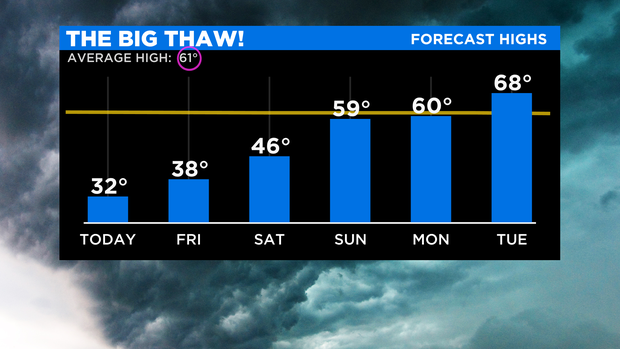
So just how drastic will this change be? From Thursday to the middle of next week, high temperatures will be 40 degrees warmer. Talk about weather whiplash!