Rain chances return to North Texas late Tuesday night
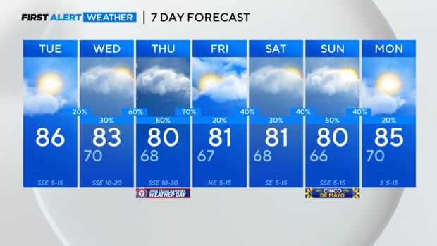
NORTH TEXAS — As we move through this Tuesday morning, a few folks will have to dodge areas of patchy fog here and there. Otherwise, as we move through the day, we'll see a mix of sun and clouds. Highs will be in the mid-80s.
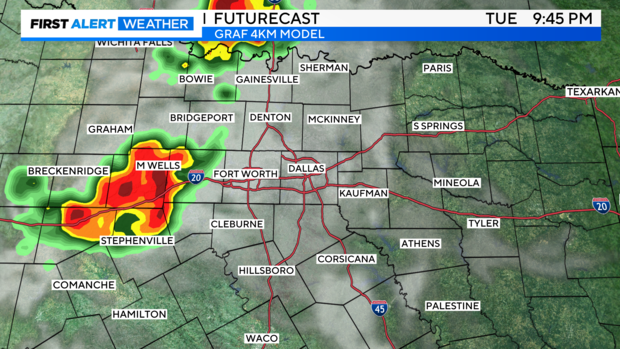
Later this evening and tonight after 7 p.m., a few thunderstorms could develop east of the dry line, mainly for areas west of I-35.
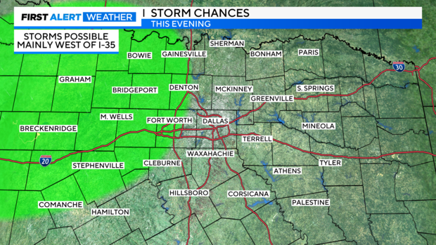
Any storms that develop could produce heavy rain, gusty winds and potentially some hail. Most of the models weaken the storms as they approach the Metroplex.
Overnight low temperatures will be in the upper 60s to near 70 degrees.
Get ready for even more showers and storms this week into your weekend.
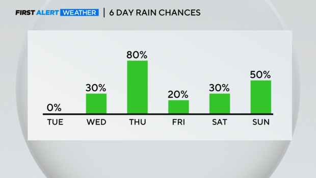
We'll likely see scattered showers and storms Wednesday into Thursday as a cold front pushes into North Texas from the northwest. The front could produce a few strong or severe storms, especially late Wednesday night into Thursday.
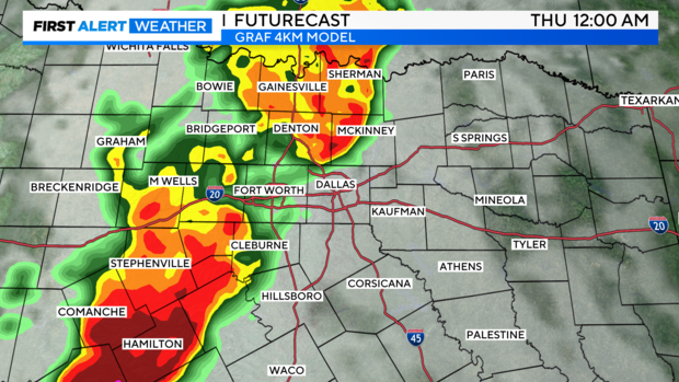
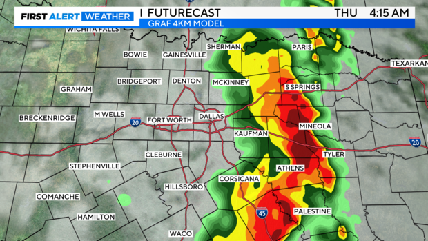
Any storms that develop will be capable of producing heavy rain and gusty winds. Hail is also possible.
A few more storms could develop late Thursday afternoon and evening. Highs will be in the lower 80s.
Not as much rain is expected Friday, but the chance for storms will increase through the weekend. While we're not expecting a washout, have a backup plan for your outdoor plans. Rain chances on Saturday are around 30-40% and on Sunday (Cinco de Mayo), rain chances are around 50%.
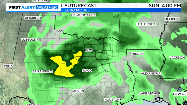
Highs will be in the lower 80s this weekend.