Rain chances return to North Texas as the work week begins

Following a soggy day across much of North Texas, we're experiencing a bit of a lull in activity, but it's very short-lived. A First Alert Weather Day is in effect for Tuesday, with all modes of severe weather on the table.

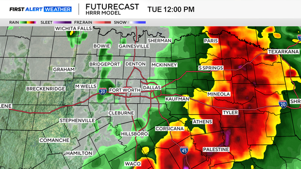
Showers and storms are quick to return Tuesday morning, with on-and-off shower activity right during the morning drive.
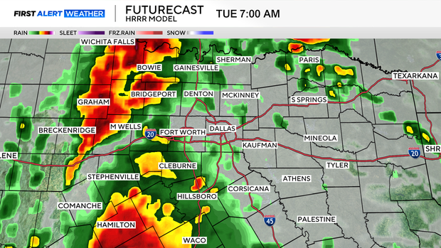
Our greatest severe threats during the morning look to be damaging wind gusts, and a large hail threat. This activity continues throughout the morning and into the afternoon, but by the afternoon, we are looking at a low-end tornado threat as well, as a warm front lifts northward through North Texas.
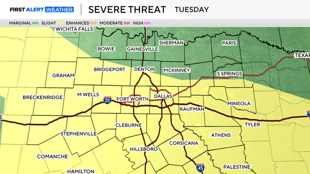
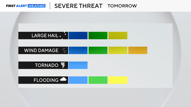
The greatest tornado threat looks to lie along and south of I-20 for Tuesday afternoon.
On top of all of this, we have a Flood Watch in effect all day Tuesday, for much of North Texas.

This is following heavy rains last week, and steady rains on Monday. Tuesday's rain only adds to already very soggy soil, so flash flooding is of elevated concern.
The shower activity then looks to taper by late afternoon and early evening.
By midweek, we're looking at drier weather, and only isolated shower chances for Wednesday and Thursday. For Friday, a few spotty showers will be possible as an area of low pressure slowly pushes eastward through the plains.
After that, we are looking at a calmer weather stretch, with a beautiful forecast for Mother's Day.
Highs look to stick a couple of degrees shy of normal, with highs in the upper 70s and lower 80s. Enjoy the milder temperatures, summer is right around the corner.