Partly cloudy skies, pleasant temps for North Texas before active weather returns

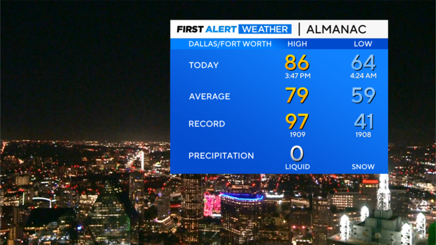
NORTH TEXAS — Monday, we saw beautiful blue skies and high temperatures in the mid-80s as the upper-level trough exits to the NE and weak upper ridging builds in its wake.
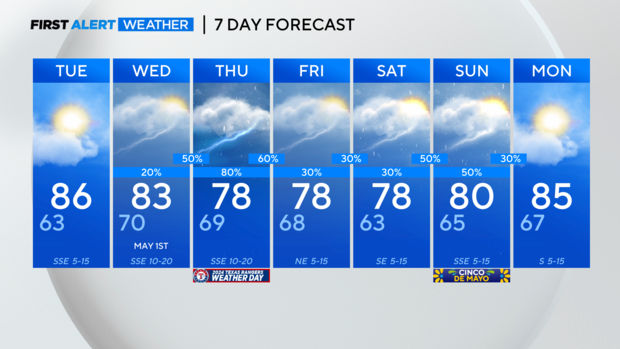
Tuesday, the ridge will be in charge allowing us to have another nice day. Temperatures will warm above average into the mid-80s again. Then the active pattern returns mid-week with the next cold front on the way.
Rain chances return Wednesday and remain in the forecast through the weekend.
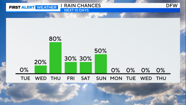
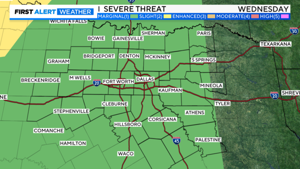
A cold front approaches from the west on Wednesday and while the majority of the day has a 20% chance the coverage increases Wednesday night to 50% as the front approaches. There will be rounds of rain Wednesday night and the potential for strong to severe storms.
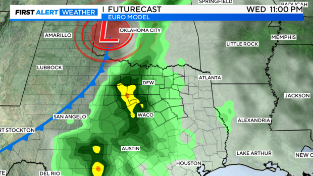
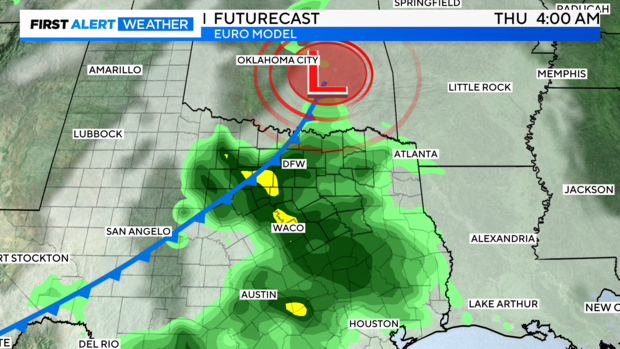
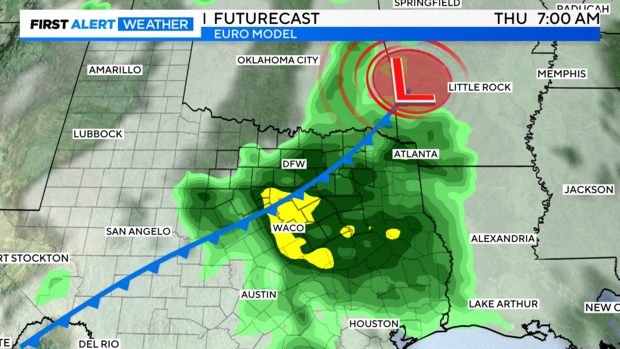
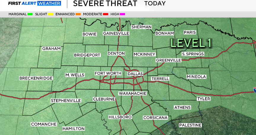
Right now the Storm Prediction Center has most of North Texas under a marginal risk of storms reaching severe limits.
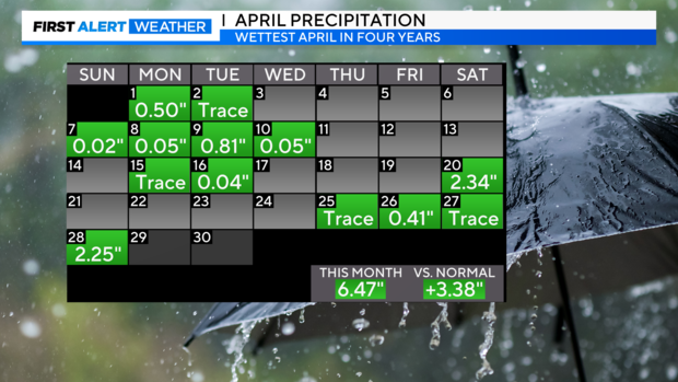
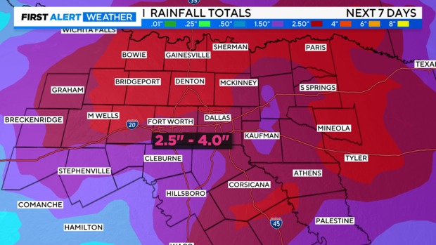
On top of the possibility of strong winds and hail there is a flooding threat. This is the wettest April we've had in 4 years with more than 6" of rain. The ground is saturated so any additional rain could lead to runoff with even more rain in the forecast this weekend the flooding threat increases. We could see an additional 2.5"-4" over the next 7 days.
Strong to severe storms are possible on Sunday as an area of Low pressure moves through. Stay weather-aware this weekend.