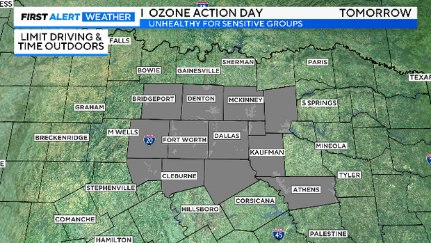
Ozone Action Day Sunday, elevated fire risk returns Monday

NORTH TEXAS (CBSNewsTexas.com) - There was a sprinkle or two early Saturday morning, but nothing official.
Highs Saturday stayed in the low to mid 90s, a break from the sweltering heat. Sunday will have a very nice start with lows in the upper 60s and low 70s, perhaps the coolest morning at DFW this month. You'll likely also notice the lower humidity, especially by afternoon.

Sunday is an Ozone Action Day along with light winds from the east. Ozone Action Days are issued when ozone levels are expected to reach levels that are "unhealthy for sensitive groups" or higher.
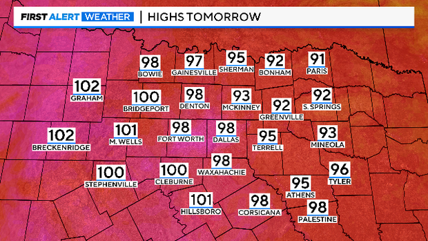
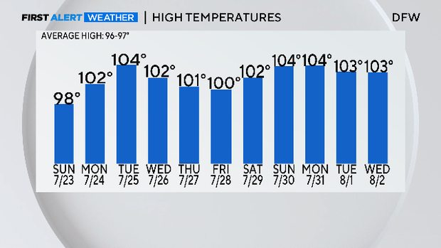
Triple-digit highs return Monday. Current forecasting has at least 10 days in a row like this, all the way to start of August.
There are no Heat Advisory's anywhere in North Texas Sunday. There is an Advisory currently in place for our very southern edge to 8 p.m.
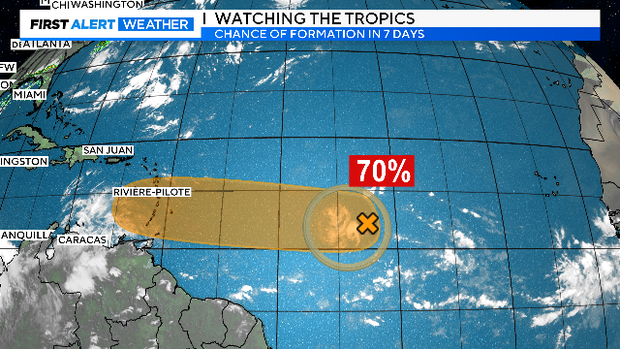
The First Alert Weather Team will advise on any heat alerts coming up here in the last week of July. The other thing we are keeping an eye on is a developing tropical system out in the Atlantic. The water is the warmest ever recorded but we are also locked down in a hurricane-suppressing El Nino. We'll see which one wins the battle.
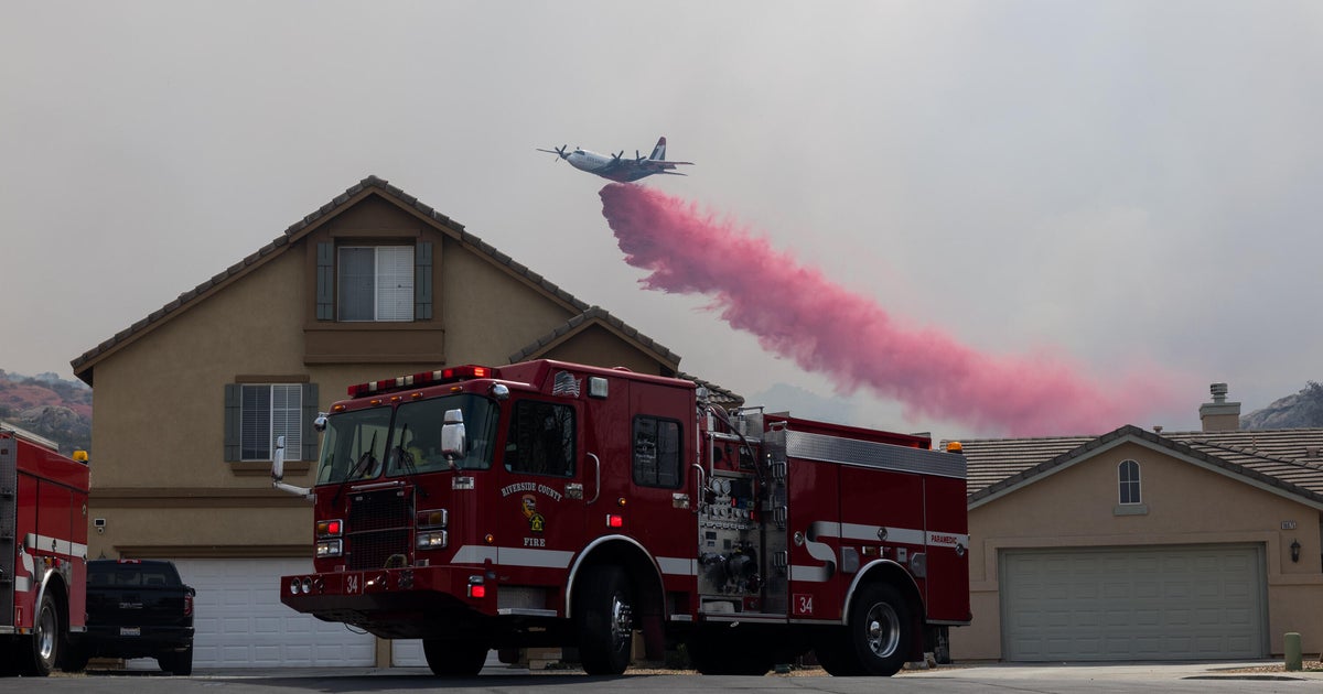
We also need to keep in mind the elevated fire risk. It returns on Monday and will likely stay in this state for the week ahead. Drought conditions are likely to spread. This has been the driest start to summer since 1980 and there is no rain in the forecast in the week ahead.

Here's the hot and dry 7 day. We are in summer lock down.