Hot end to the North Texas weekend as thunderstorm chances kick back up

There are reports of wind damage on Sunday night after a thunderstorm moved through Parker County. Downed tree limbs have been reported in Willow Park around FM 730.
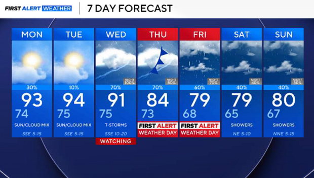
On Monday afternoon, more storms are possible. The morning low will be in the mid-70s and the high in the mid-90s. Expect partly cloudy skies and winds from the south at 5 to 10 mph.
Rain, cooler temperatures return to DFW
A better chance of rain is expected next workweek.
An upper-level trough strengthens as it moves from west to east. At the surface, a cold front will tap into moisture from the Gulf and the Eastern Pacific. This will lead to storms and a healthy chance of rain.
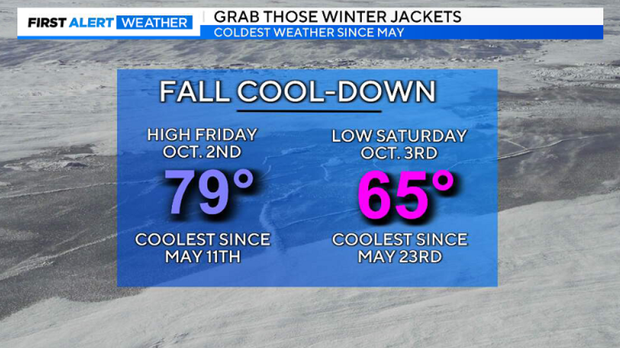
Rain returns on Wednesday and the heaviest rain is expected on Thursday. Highs look like they will drop to the 70s with lows in the 60s. We are looking at the coolest temperatures since May in North Texas.
We have issued a First Alert Weather Day for Thursday and Friday. We will see strong-to-severe thunderstorms move in later this week. Severe weather is possible, but we are mainly watching for flooding rainfall along the I-35 corridor, including the metroplex.