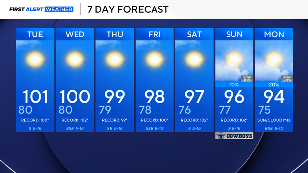
North Texas faces a hot and dry week with high fire danger


The dry and hot spell continues for North Texas.
There have officially been 61 consecutive days without measurable rainfall at DFW Airport, tying for the third most consecutive dry days on record.
North Texas will stay mostly dry this next week. A ridge of high pressure will continue to bring on the heat and dry weather throughout the next week. This will increase fire danger, since winds will be a bit gusty.
Monday, DFW reached 100 degrees, making it the 50th triple-digit day so far this year, the sixth most recorded on record. The normal amount of 100-degree days is 20 per year.
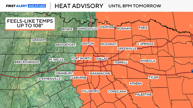
A heat advisory is in effect until 8 p.m. Tuesday due to a heat index known as the feels-like value reaching up to 108 degrees. Please be sure to take heat precautions.
The rest of the week, the temperature will be extremely hot and potentially record-breaking.
It's not until next week, when a cold front is expected to swing through the area. As of now, forecast models are inconsistent on the timing of the front and about how much rain or how cool it will get. Just know there is a glimmer of hope for some much-needed precipitation and a cool down in the near future.