Record heat expected over next several days in North Texas; heavy rain possible mid-week


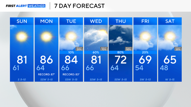
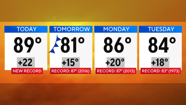
Saturday's high temperature of 89 in DFW may not be the final heat record broken this month.
The typical high temperature for this time of year is 67 degrees, but the forecast high for Saturday hit a record 89 degrees. This is two degrees above the previous daily record high of 87, set in 1960.
Not only has it been sunny on Saturday, but wind gusts of up to 25 mph are present.
A dry and weak front will move through Saturday night, knocking temperatures down a couple of degrees on Sunday.
But on Monday, a record is possible again, with the forecasted high within one degree of the record. The current forecast for Tuesday is one degree above the current record high, set in 1973.
After that, a big change is in store.
The ridge of high pressure that is dominating the atmosphere will shift eastward and a low pressure system will move in to North Texas. The system will bring a cool down heavy rain, which could lead to flooding concerns.
By the end of next week, temperatures will return to the 60s and it will feel like fall again.