Muggy Tuesday in store before storms arrive to North Texas
NORTH TEXAS – Good morning! Tuesday's skies are cloudy and temperatures are in the 70s. It's warm and muggy, and there's a decent southerly wind this morning.
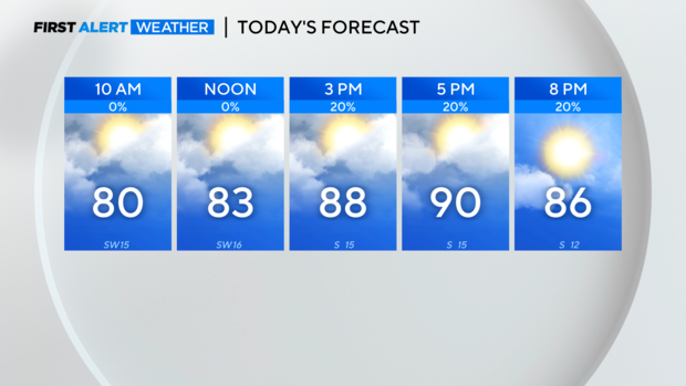
As the breeze continues today, moisture will only continue to increase. That means feels-like temps will be a few degrees warmer than the thermometer this afternoon and it also means there will be plenty of instability for some storms over the next few days.
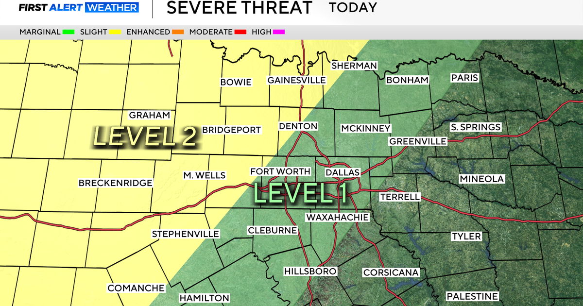
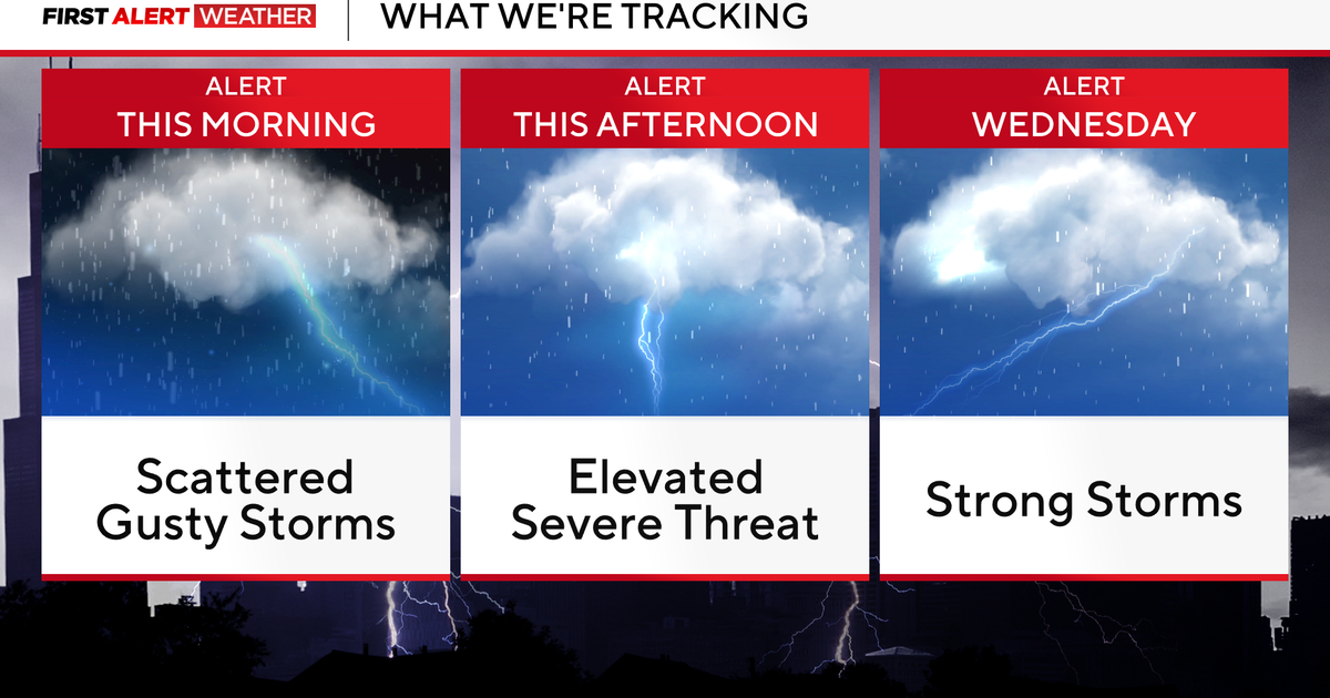
As we head into this afternoon, you'll notice storm chances increase to 20%. While most will stay dry, we'll want to keep an eye out for dryline storms to the west. There's a CAP in place and we're expecting it to hold, but if the CAP did weaken or a storm did punch through it then there would likely be some isolated storms with hail.
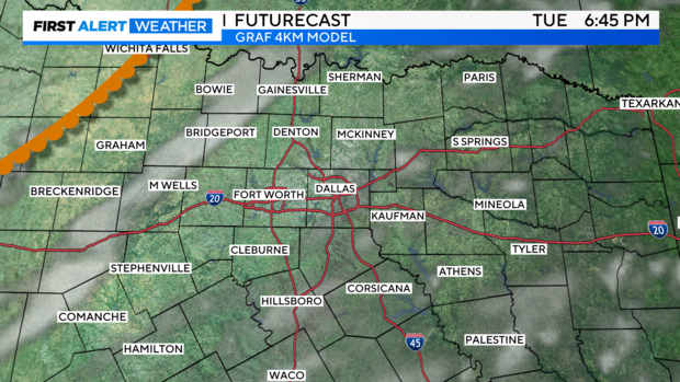
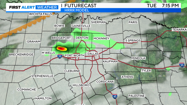
Notice the two different high-resolution models with two different scenarios for today. We are leaning towards the CAP holding, which means no storms. But, we'll watch how the afternoon plays out. If we see a little more sunshine, that could weaken the CAP.
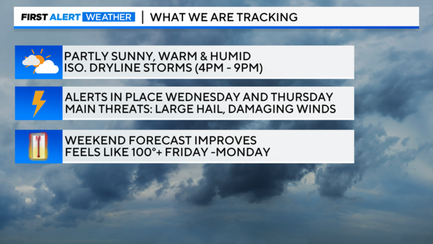
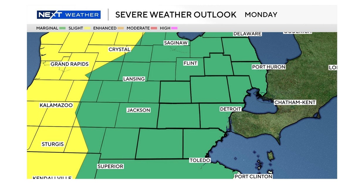
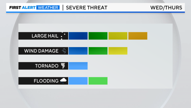
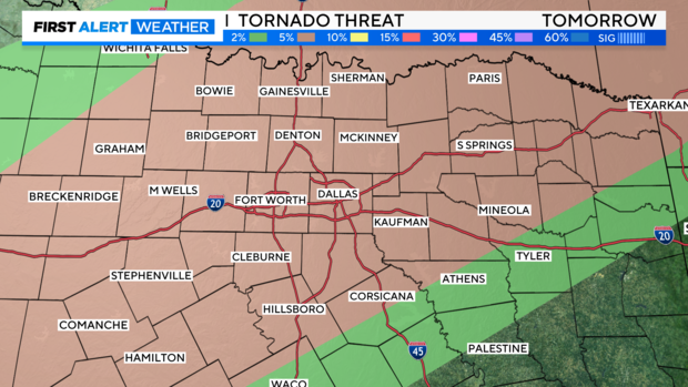
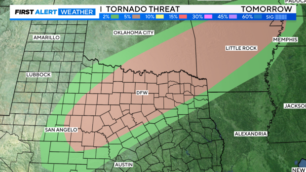
CBS News Texas meteorologists have issued weather alerts for Wednesday and Thursday. The timeframe still looks to be mainly afternoon and evening for both days, at least based on what we're seeing Tuesday morning. The Storm Prediction Center does have most of the area highlighted under a Level 3 "Enhanced" risk Wednesday and a Level 2 "Slight" risk for Thursday.
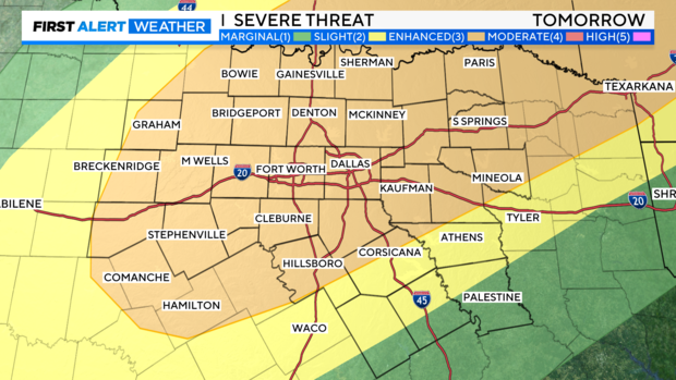
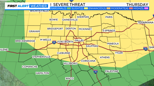
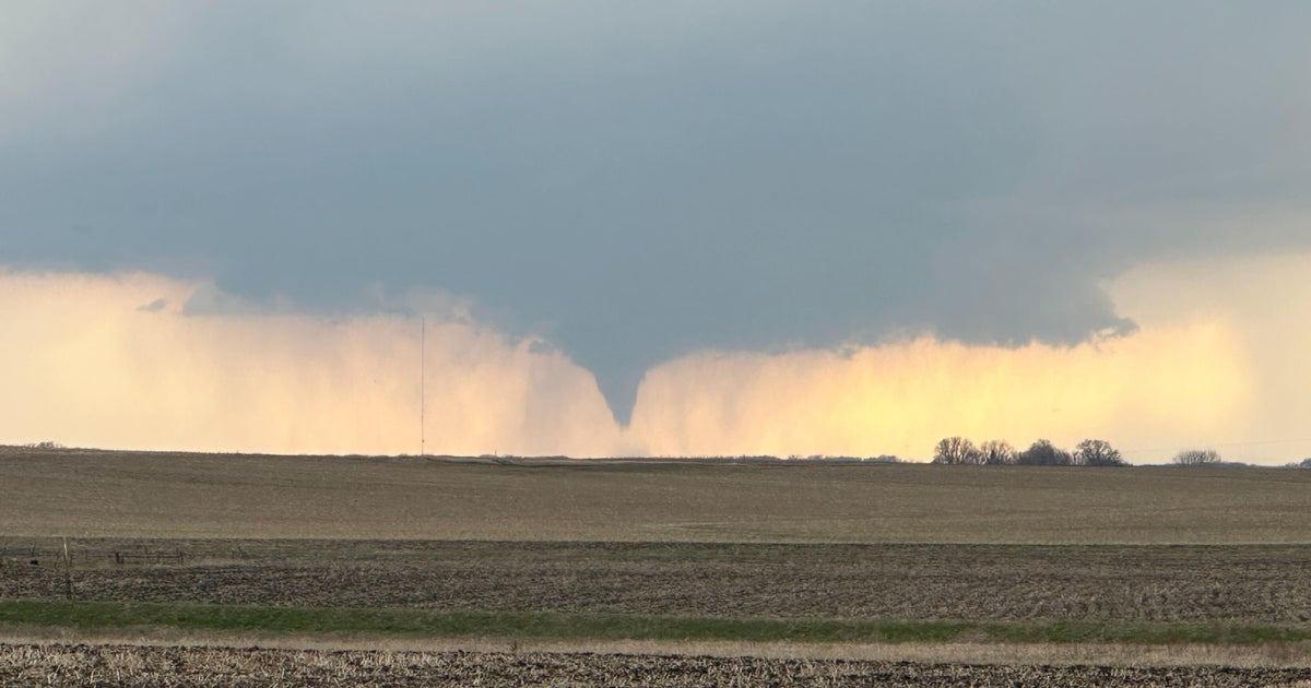
The main threats on both Wednesday and Thursday look to be large hail and damaging winds. Of course, with how wet a spring we've had, any heavy rain will exacerbate ongoing flooding issues. Regarding the tornado threat, it's low and conditional. It'll be dependent on frontal timing and placement on Wednesday, but we'll be watching this closely.
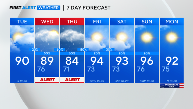
Once the severe weather moves out heading into Friday, it becomes more of a heat/humidity forecast. When we get into this summer-like pattern, isolated afternoon storms are possible but not a major concern. The bigger concern heading into the holiday weekend will be the highs in the low to mid 90s and the feels-like temps nearing at least 100 degrees.