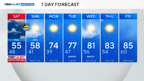
Morning storms and temperature drop expected on Saturday's First Alert Weather Day
We had the sun break out this afternoon to reveal a hazy sky. As a front approaches, arriving late tonight, it is pulling up air from the southwest. This wind tapped into smoke from fires in Mexico.

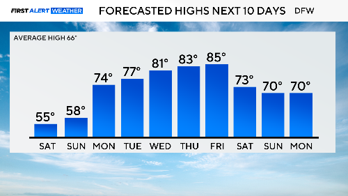
We still reached the 80s today, with a high of 82°, officially making it the warmest day so far in March. This weekend will be much different.
The cold front that arrives tonight will be followed by storms coming in from the west. We have a marginal risk of severe weather in the morning, with large hail and gusty winds being the main risk.
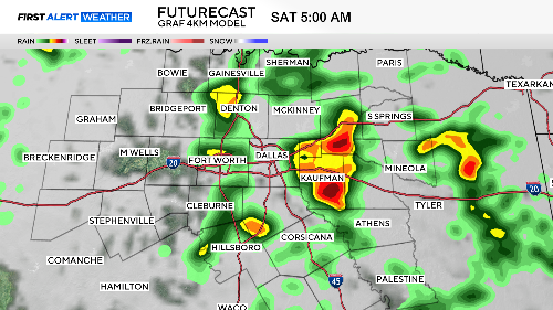
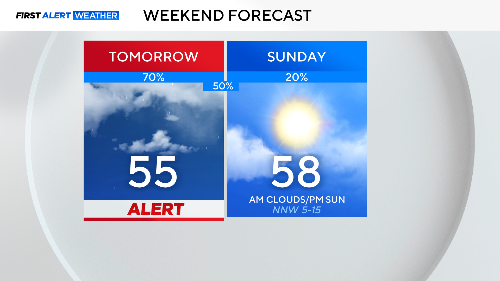
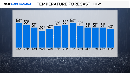
The storms will move out in the morning, but we'll have some showers on and off throughout the day. Temperatures will drop in the morning before "recovering" to the mid-50s. Expect a cloudy, chilly day on Saturday with gusty winds. Dress for the cold.
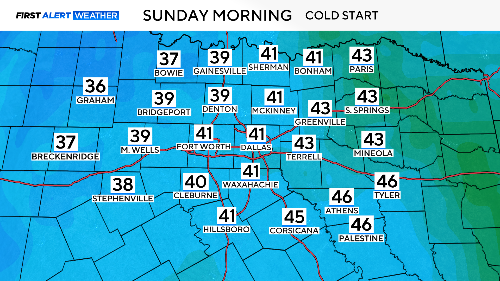
Only be slightly better for Sunday, with temperatures in the upper 50s and some early rain in our eastern counties. The next two days will be the coldest in the ten-day forecast. We'll be back to some dry spring weather by Monday.
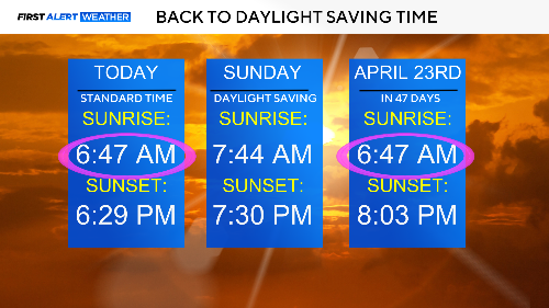
This is the weekend we turn the clocks forward. We lose an hour of sleep, but nighttime holds off until later on Sunday.
We have a couple of cold nights to get through. Not freezing, but in the 30s for some.
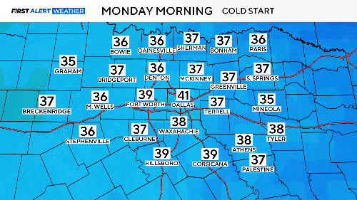
After our chilly weekend and chilly Monday morning, spring is back to stay with us for a while. We'll close next week right back in the 80s.