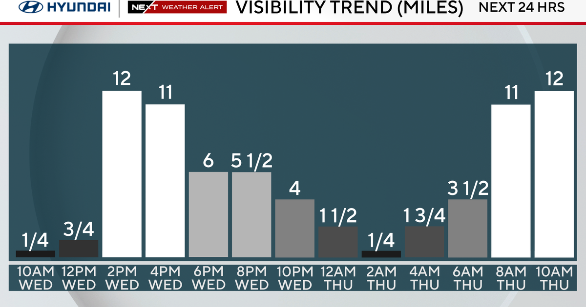
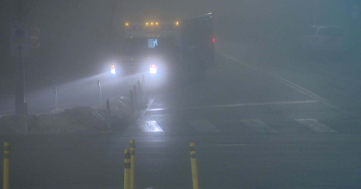
Morning Fog, Afternoon Sun
The clouds that have hung over north Texas for days finally started to clear out this afternoon. As the clearing continues overnight the winds go calm over this wet ground. This is a classic recipe for a thick fog to form, especially in the low-lying areas:
The fog should clear quickly; we are going to have a great afternoon. Get outside for lunch if you can. By afternoon some of these garden beds, ball fields and trails might actually be dried out some!
We've had a run of remarkable storm-free weather across the United States so far this year. The Storm Prediction Center has issued a grand total of FOUR Tornado Watches and ZERO Severe Thunderstorm Watches. This is a mere 10% of normal by this time in the year.
The lull ends on Tuesday. We are expecting a severe weather outbreak across Missouri on Tuesday:
On Wednesday Night the at severe weather could be here. By afternoon on that day we'll likely have severe cells form along the front where it hits the dryline to our west:
We'll be in the 80's and humid; plenty of fuel for this storms as they form a line and charge for the Metro. Large hail and damaging winds are possible:
We'll go from the 80's to the low 60's the next day as the skies clear and a strong northwest wind blows:
The storm threat Wednesday night includes large hail and damaging winds:
Another shot of cold air comes in on Friday. We could be in the 30's for a low by Saturday morning before we start warming up again:


