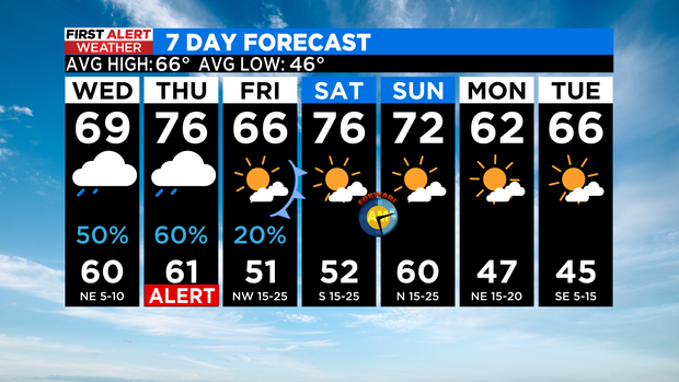
Keep the umbrella handy, rainy weather in the forecast
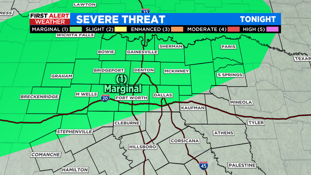
NORTH TEXAS (CBSNewsTexas.com) – Storms are likely Tuesday night along the northern third of our area including the Metroplex. The main threat will be brief heavy rain along with hail. There is a MARGINAL chance of severe weather, especially along our Red River counties:
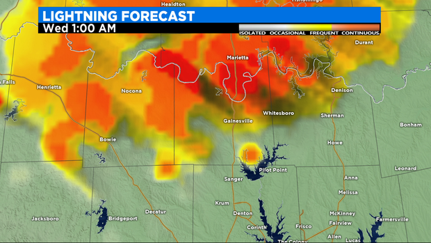
Here is a look at the lightning forecast from our BAMS model. Notice this is 1 a.m. Tuesday night and it shows a significant lightning display in progress along the Red River Valley. There could be ¾" hail with this. Some of this could reach down into Wise, Denton and Collin counties before daybreak.
We are expecting some fast moving showers Wednesday. There could also be some impressive lighting with these along with hail up to 1" in size but, again, there is only a MARIGANAL RISK of severe weather.
A FIRST ALERT is in place for THURSDAY.
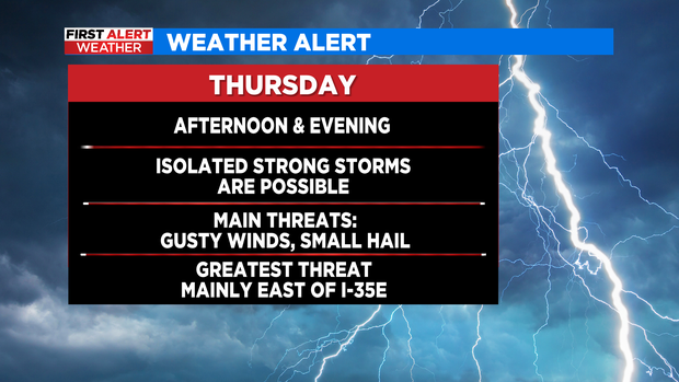
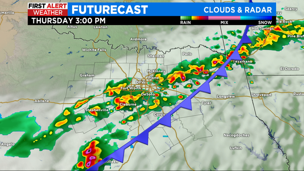
Look for some storms to develop Thursday afternoon and move east while getting stronger. Heavy rain and large hail is possible. Currently the SPC has NO risk of severe weather for Thursday but we suspect this will change. Here is how the BAM model looks for Thursday:
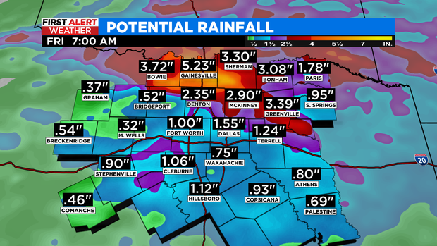
So in summary, there are several chances of rain and a marginal risk of severe weather over the next couple of days (including early Friday). Some of the forecast models show 2"-3" of rain over the next couple of days. The heaviest amounts will likely fall where there are the strongest storms, across our northern third. Flash Flooding could be added as a threat:
Don't forget, we SPRING FORWARD the clocks one hour Saturday night, losing an hour of sleep. The average LAST freeze for DFW is on Sunday. There are no freezes in the forecast in the 7-day: