Flood watch in effect as rounds of heavy rain move through North Texas this weekend

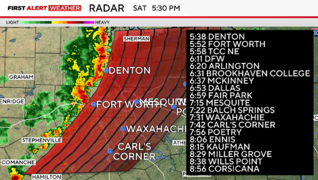
A line of storms is crossing North Texas.
Strong winds, frequent lightning, small hail, and flooding rainfall are being reported.
Storms are moving east at 25-30 mph.
ORIGINAL STORY
A mid-level, slow-moving upper-level low is tapping into sufficient Gulf moisture this weekend, leading to heavy rain and flooding concerns. Totals over the next 36 hours could range from a couple of inches to localized totals of around 6 to 8 inches.
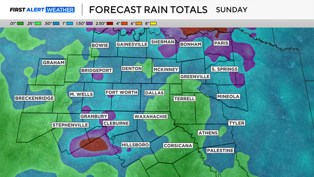
Grounds are already saturated, so additional rainfall will lead to flooding in low-lying areas across parts of North Texas. A Flood Watch is in effect until 4 p.m. on Sunday.
The first-round showers and storms will move eastward through the rest of Saturday morning with the activity tapering off in the early afternoon. A few storms will be possible through the afternoon, with another round of scattered storms moving west to east in the late afternoon and evening.
Isolated severe storms with damaging winds, hail, lightning and intense rainfall rates will be possible.
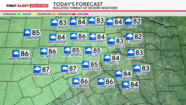
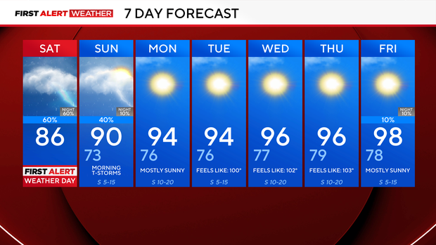
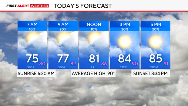
Saturday will be cloudy, with a high in the mid-80s and southeast winds around 5 to 10 mph.
On Sunday, there will be a chance for additional storms through mid-afternoon.
By the evening, conditions will be clear. Expect temperatures to climb into the low 90s, with a heat index (feels like) in the upper 90s in the afternoon. Drink plenty of water.
Next week, a high-pressure system will build, allowing for conditions to heat up and the sun to shine. Highs will reach into the mid- and upper-90s, heat index values will be around 100 degrees, and winds will be breezy from the south.
Get ready for summertime to kick in full force.