First Alert Weather Day for Sunday due to risk of severe weather
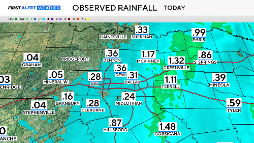
A light, steady rain began Thursday night, allowing much of it to absorb into the dry ground. This type of rain quickly greens the early spring landscape.
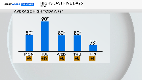
We enjoyed cooler temperatures today, ending a short run of days in the 80s and one day in the 90s.
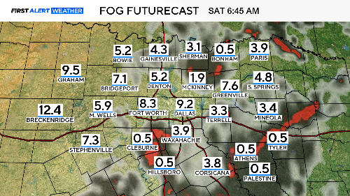
Skies are slowly clearing tonight, allowing some fog to form. If your Saturday starts early, please slow down if the fog is thick in your area.
For your weekend, temperatures will return to the 80s. It will be a little humid and breezy tomorrow afternoon but storm-free. Storms are possible late Saturday night and again Sunday afternoon.
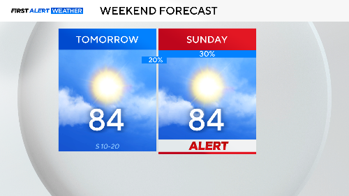
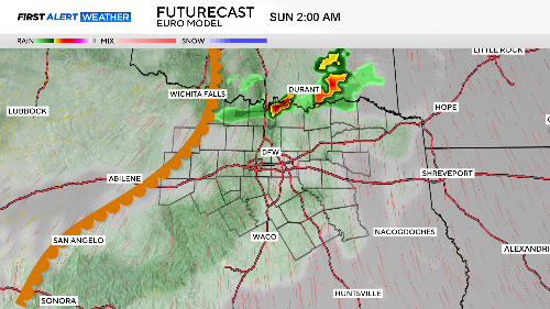
The dryline from the west, which divides dry West Texas desert air and coastal humid air, will move into the Metroplex by the end of the day. This could trigger some late-night storms.
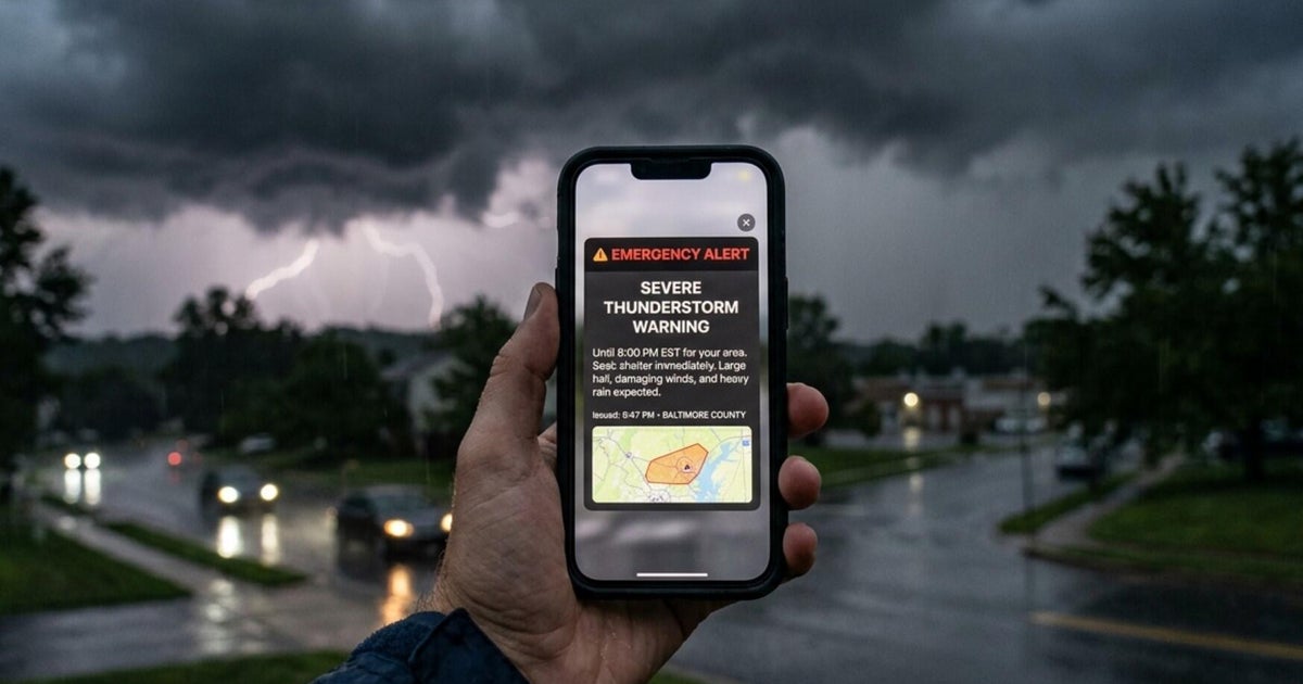
These storms could produce damaging winds and large hail. The higher threat of storms arrives with a cold front Sunday afternoon.
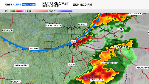
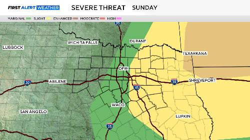
These storms also present a risk of damaging winds and large hail. Isolated tornadoes are possible, but the chances are small. The eastern half of North Texas is under a slight risk of severe weather, so please be weather-aware as you close the day on Sunday.
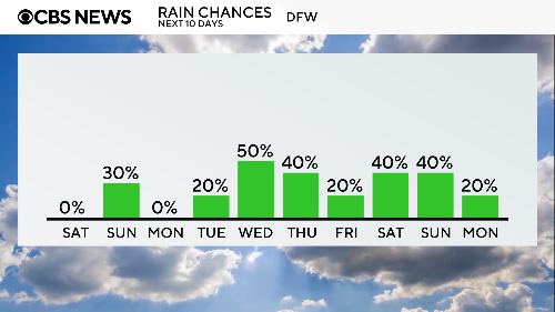
Monday, the last day of March, looks nearly perfect. April starts with lots of showers and storms in the forecast, with a chance of rain each day.
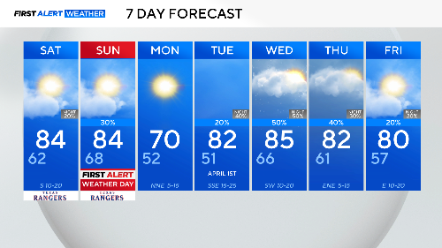
It's good to see rain back in the forecast; no one likes a drought in the spring. Eight of the next ten days show storm chances.
The First Alert Weather Team will keep you posted on these storms Sunday afternoon. If severe weather occurs, pull up CBS News Texas on your smartphone. We'll have extended weather coverage and updates on CBS 11.