Rain, wind and storms prompt First Alert Weather Day in North Texas as coldest air of the season moves in

Occasional showers and clouds lingered on Saturday morning. Later in the afternoon, a front swept across North Texas, triggering a few strong to severe storms.
A severe thunderstorm warning has been issued for Alvarado, Venus, and Itasca, remaining in effect until 5:45 p.m.
The Storm Prediction Center has issued a marginal threat for isolated severe storms in the areas highlighted in green below. The biggest threat is hail and damaging winds.
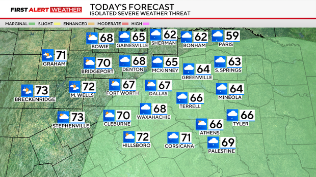
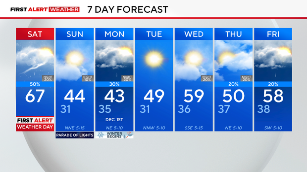
Behind the front, winds pick up from the north, and temperatures will rapidly drop. The highs will hit the upper 60s and low 70s Saturday, but temperatures will drop close to freezing by Sunday morning. Dress for the cold.
Highs on Sunday will only be in the 40s with some afternoon sunshine. Brisk winds will make it feel colder. In fact, wind chill values could be in the 20s.
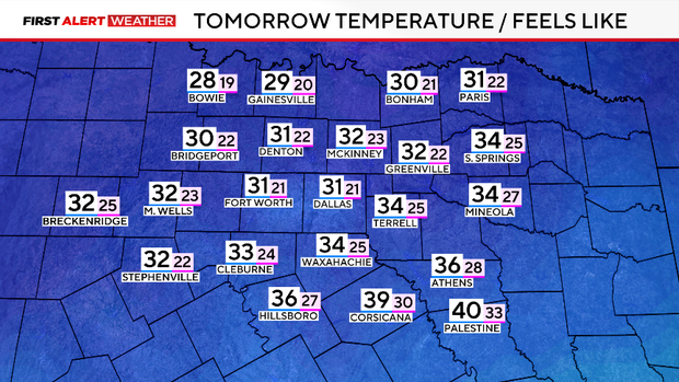
The first freeze of the season should have been a week ago if DFW had followed the 30-year average. Instead, it will get close Sunday morning but will almost certainly get there Tuesday morning.
Meteorological winter starts on Monday, Dec. 1. That first-of-the-season cold air that arrives on the last day of fall starts the work week. These will be the first days in the 40s with lows in the 30s for several nights straight.
A cold rain on Monday might also have a little sleet mixed in – feeling like winter. Another chance of rain shows up late Wednesday and Thursday.