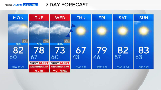
Beautiful start to week before round of rain, severe storms hits North Texas midweek
Monday, temperatures start in the 60s and quickly climb into the 80s by the afternoon.
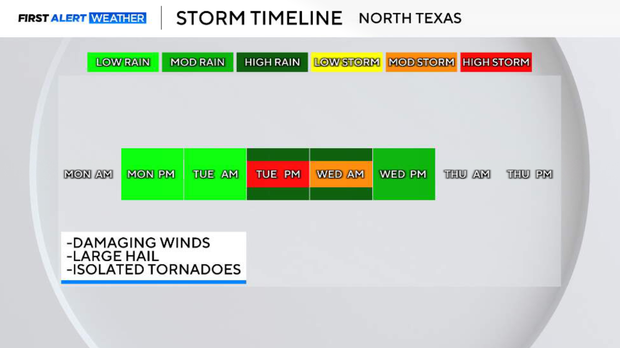
Cloud cover will begin to build as an upper-level low-pressure system approaches North Texas. Winds will be breezy, gusting up to 20 mph at times. A few isolated storms will be possible, especially for those to the east of the Dallas-Fort Worth metroplex.
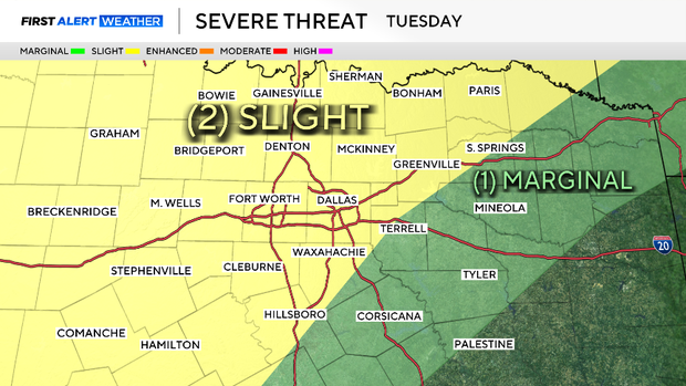
The next big weather maker swings through the area on Tuesday, causing the chance of severe weather.
As of now, the Storm Prediction Center has highlighted a slight risk, level 2 out of 5, indicating the confidence is high for scattered severe storm development. There is a capping inversion that will be in place on Tuesday, so severe storms will be dependent on the environmental factors.
Large hail, damaging winds, flooding rainfall and an elevated, non-zero threat for tornadoes will be possible.
Rain will continue overnight through Wednesday morning. An additional inch or so of accumulation will be possible. After the front swings through, conditions clear.
Thursday will be seasonal, cool and sunny. Temperatures climb through the rest of the week into the weekend due to a ridge of high pressure.