Clouds and cool temperatures continue to blanket North Texas before late week warmup and possible storms

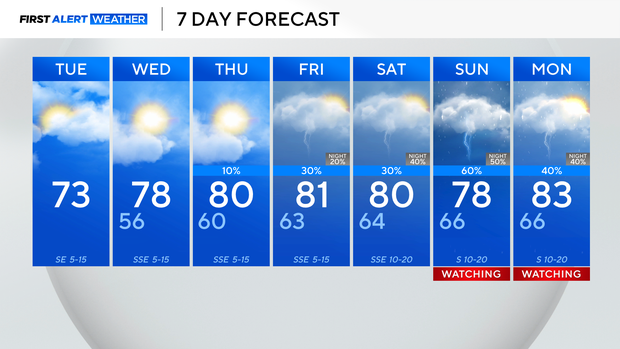
It's another cool start with temperatures in the 40s and 50s across North Texas on Tuesday morning.
Throughout the day, don't expect to see much sunshine as plenty of clouds stream into the region as a disturbance is out west. It may feel a little cooler under the cloud cover, but highs rise into the lower 70s by Tuesday afternoon.
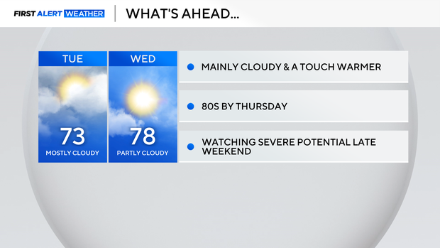
Expect to see a mix of clouds and sunshine on Wednesday with highs in the upper 70s.
It will continue to warm into the 80s on Thursday and Friday, but on Friday, there's a chance of a few pop-up thunderstorms.
The same may be true for Saturday – the severe threat will be well out to the west.
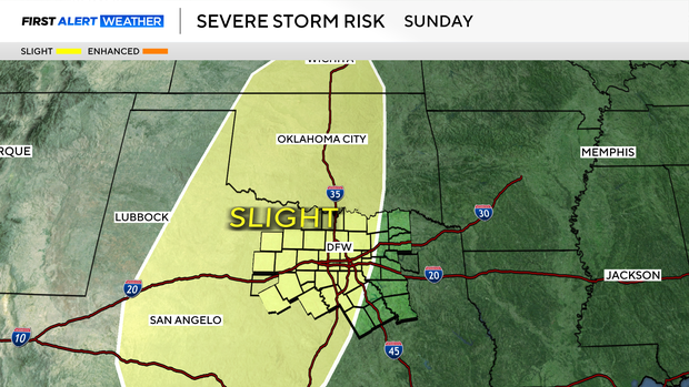
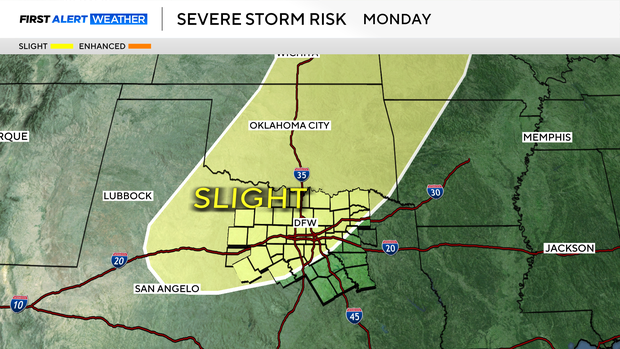
As an upper-level system moves closer, there's also a chance of strong to severe storms on Sunday and Monday.
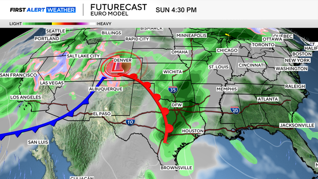
While it is still too early to narrow down the specifics and timing, the First Alert Weather Team is watching those days.
As of now, if you have outdoor plans for Sunday, plan for a way to bring them inside just in case.
The weather looks likely to stay wet next week with more showers and storm chances on the way. The Climate Prediction Center has forecasted DFW to receive above-normal amounts of rain for the middle of the month, and this forecast looks to be holding up.