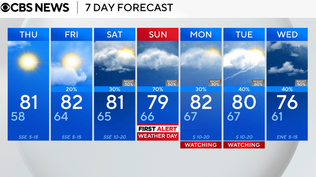
Temperatures rise back into 80s across North Texas ahead of possible isolated showers and storms by weekend

North Texas will see multiple rounds of showers and storms heading into the weekend.
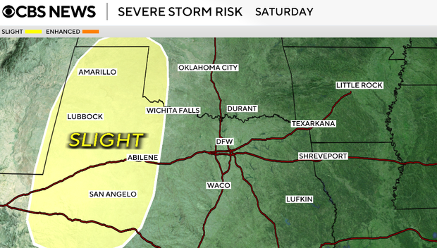
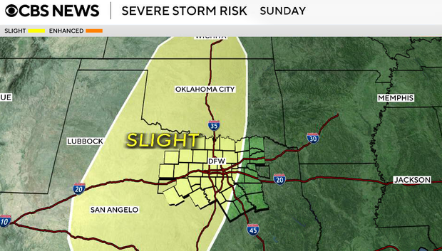
Conditions stay mostly dry through Thursday and Friday, with limited severe storm chances locally on Saturday, too. The better potential for strong to severe storms arrives Sunday through Tuesday, with damaging winds and hail as the primary threats, along with heavy rain that could lead to localized flooding.
Wednesday night will be mostly clear, with light winds and temperatures falling into the upper 50s.
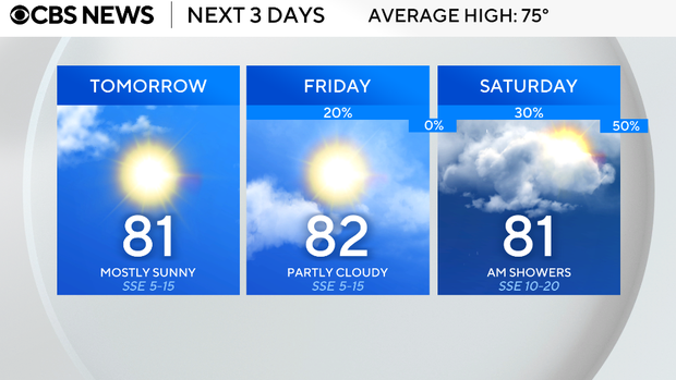
On Thursday, we will see sunshine early, then increasing clouds and a bit more humidity. A warming trend continues as southerly winds strengthen, helping bring in more moisture from the Gulf. Highs climb to around 80°.
Sunshine fades quickly on Friday due to increasing clouds in the afternoon. With southwest flow developing aloft and a dryline setting up to our west, we'll introduce a low chance for isolated showers or storms by the afternoon. Most of North Texas will stay dry, with better storm chances remaining west.
This weekend things become more interesting.
The dryline becomes more active and additional upper-level energy moves in, allowing storms to develop more easily.
On Saturday, storm chances increase, especially west of DFW, but some weakening is possible as storms move east.
Sunday is a First Alert Weather Day. Better setup for more widespread storms, with increasing instability and wind shear. A few storms could become strong to severe, with gusty winds and hail as the main concerns.
The active pattern lingers, with additional chances for showers and storms on Monday, Tuesday and Wednesday.