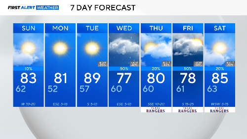
Expect temps in the 80s, small chance of rain across North Texas this weekend

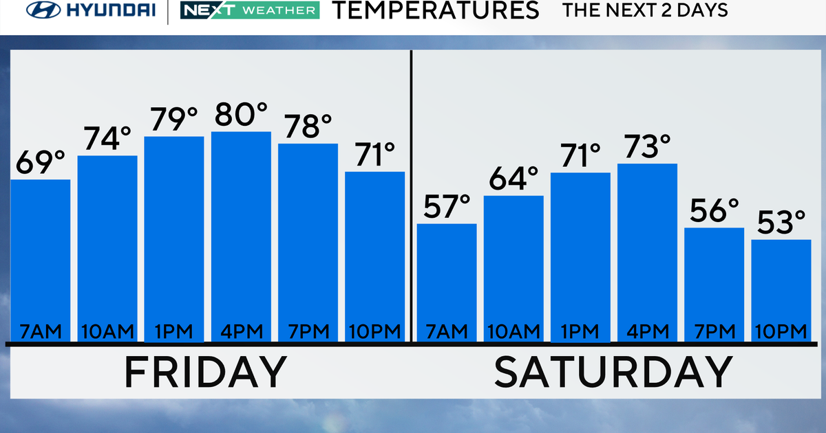
Another warmer-than-average day is expected for North Texas. An abundance of sunshine combined with a southerly wind will allow highs to climb into the 80s on Saturday, sitting 10 to 20 degrees above the normal high for this time of the year.
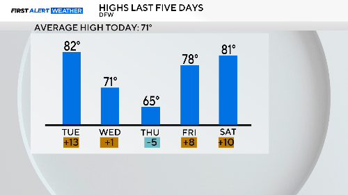
DFW returned to the 80s after a three-day hiatus.
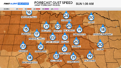
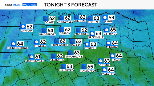
Expect a warm and windy night. After some cool mornings lately, it'll be a very warm start to your Sunday, one of the warmest nights of the young year. Winds stay up through the night.
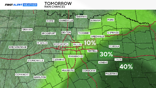
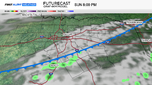
Rain chances Sunday afternoon are very modest, mostly confined to our southeast counties. Don't change any outdoor plans if in the metroplex. It'll be breezy as a cold front arrives mid-day to turn the south winds to the north. The front will trigger a few storms late in the day from Hill over to Henderson counties.
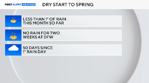
We've suffered a dry start to spring so far, just as the green-up is starting. Getting the grass to turn green will go a long way to lessen the wildfire risk.
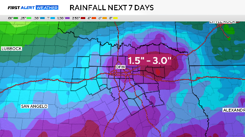
The 7-Day outlook for rainfall looks promising, we haven't seen such a generous forecast from rain in over a month.
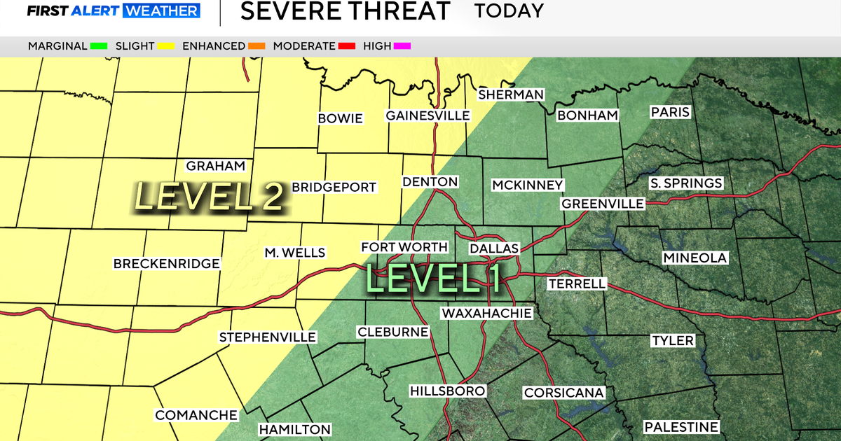
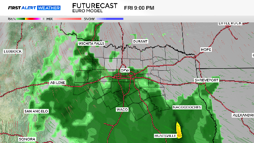
The rain chances start Tuesday late night into Wednesday as a slow-moving cold front could trigger some storms by afternoon. Currently, the risk of severe weather is marginal.

The rain chances improve greatly by late Thursday and Friday.
Fire danger will continue to be a problem until we get a good soaking rain. Elevated fire risk covers our northwest corner where winds will be stronger behind the cold front.

Meanwhile, the warm start to March continues. We could end up with a top-10 warmest month as we close out March a week from Monday.