Near record heat expected Sunday, possible wet Easter ahead for North Texas

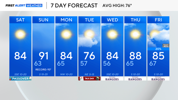
A great day is in store on Saturday with abundant sunshine and warmer than average temperatures. A ridge of high pressure in the upper levels continues to dominate the forecast pattern, keeping North Texas sunny and warm.
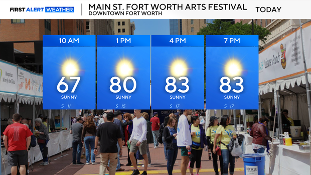
Saturday, if you are headed to the Main Street Fort Worth Arts Festival, you will have blue skies and high temperatures in the mid-80s.
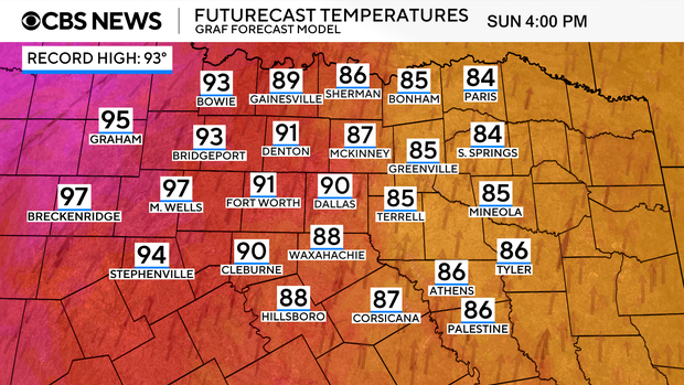
Surface winds turn more SW Sunday, and with sunny skies and dry air in place, high temperatures will soar to near record heat! Wind gets a bit breezy in response to surface developing northwest of North Texas. The compressional warming also aids the well-above-average temperatures for this time of the year.
Another thing to note for Sunday is an elevated fire threat along and west of 281.
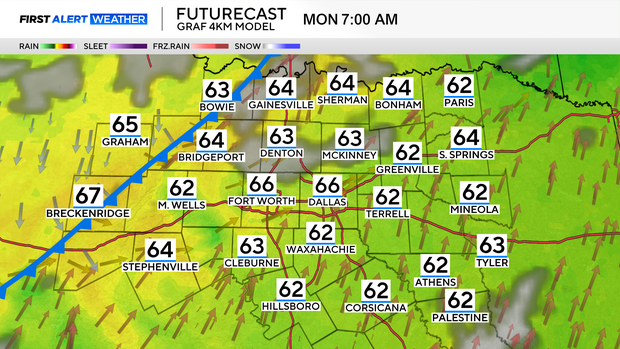
There might be a bit more cloud cover Monday, as the dry cold front moves through North Texas. But rain isn't expected to start the work week. The cold front will drop our temperatures from the low 90s Sunday to the low to mid 80s Monday. The cooler air doesn't settle in until Tuesday, with our highs in the mid-70s.
The long-range models are hinting at an upper-level pattern shift as it gets closer to Easter weekend. Unfortunately, both the long-range GFS and Euro forecast models have rain in the forecast.
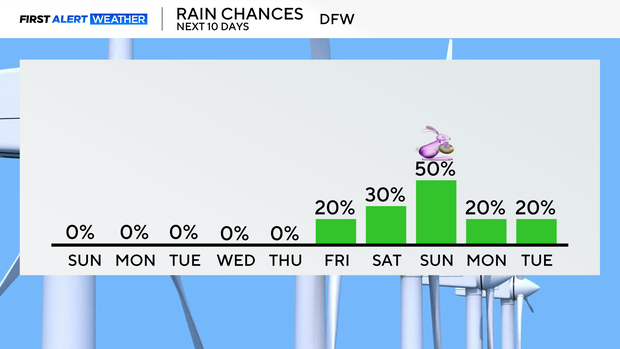
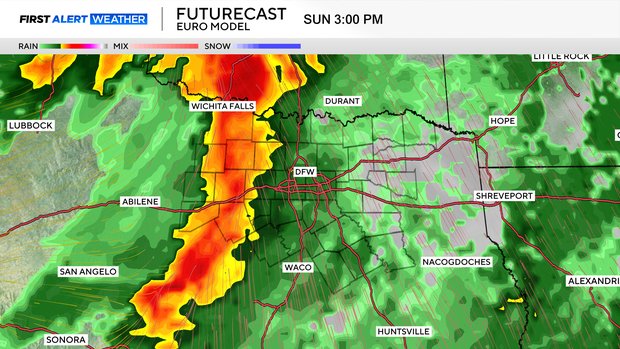
A lot can change between now and next weekend, so stay with the CBS News Texas First Alert Team for the latest forecast updates.