Storms chances return to North Texas mid-week

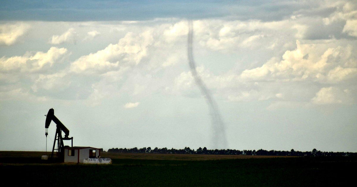
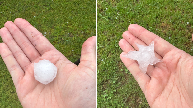
A cold front moved through North Texas Sunday afternoon/evening, bringing a severe thunderstorm warning to Tarrant County between 3-4 p.m.. This brought hail up to the size of golf balls in some of the largest hail cores.
Fortunately, our capping inversion held in place, and storms struggled to overcome the cap, which led to the end of the severe threat for Sunday.
A severe thunderstorm watch remains in effect for Delta, Ellis, Hopkins, Hunt, Johnson, Kaufman, Navarro, Rains, Rockwall and Van Zandt counties until 2 a.m.
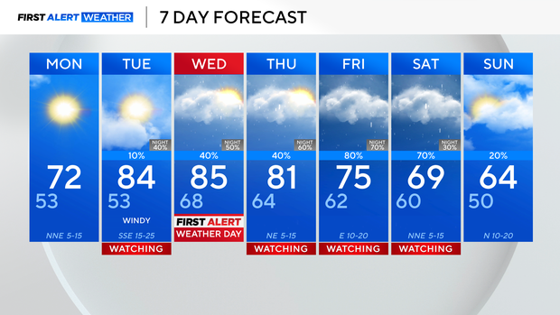
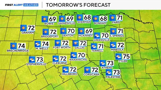
From here on out, we've got a busy week ahead. It starts calm, with sunny skies and seasonable temperatures on Monday. Highs will be in the lower 70s across most of the metroplex.
Our windflow shifts into Tuesday, with winds out of the south bringing breezy to gusty conditions, and sending highs back into the middle 80s.
Tuesday looks to remain mostly dry, with only an isolated shower threat. Our rain chances then build overnight into Wednesday and linger into the start of the weekend.
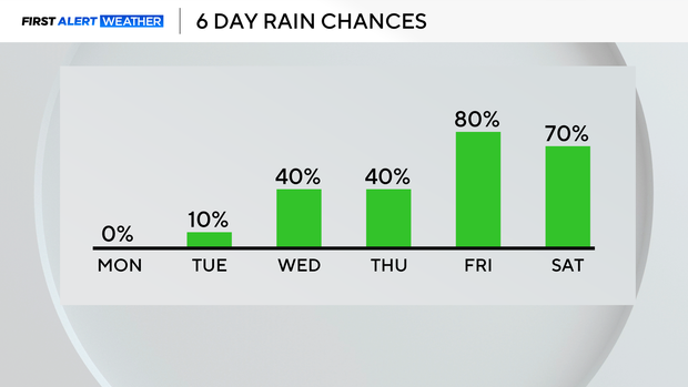
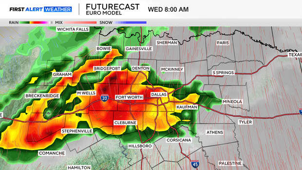
Expect rain and thunderstorms the first half of Wednesday, with an isolated severe storm threat, primarily for hail. That is followed by a lull into the afternoon and evening.
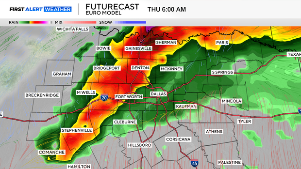
It looks like we'll see another round going overnight into Thursday morning, followed by an afternoon and evening lull.
By the time Friday and Saturday arrive, we are looking at heavier, and much more widespread shower and thunderstorm activity.
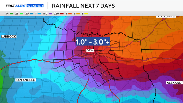
A First Alert Weather Day is in effect for Wednesday, but expect more to come later this week, with storm potential Thursday, then more widespread rain Friday into Saturday.