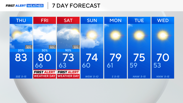
Chance of rain in North Texas on Thursday before storms roll in
North Texas will see an increase in cloud cover on Thursday, with a spotty shower possible around lunchtime. Temperatures will warm into the lower 80s in the afternoon with increasing humidity.
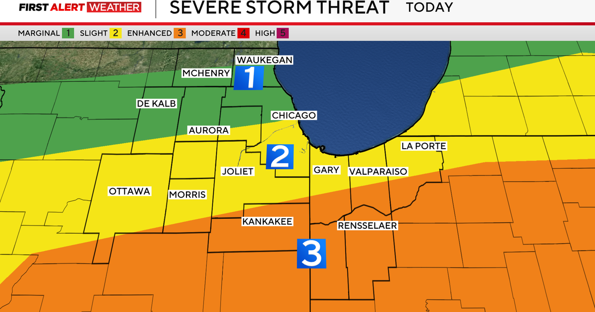
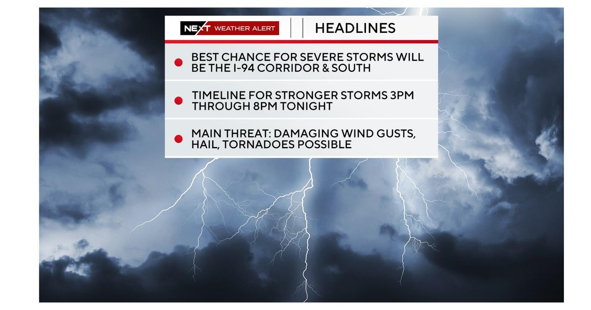
First Alert Weather Days have been issued for Friday and Saturday due to multiple rounds of rain and storms. Some storms may be strong to severe with hail and damaging winds.
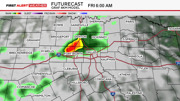
The first round will develop to the northwest on Thursday night and track southeast into Friday morning.
Some shower activity may hang on until the Friday morning commute in the Metroplex.
Right now, there looks to be a lull in precipitation from the late morning to the evening hours on Friday.
The next round of storms will come from squall line that is likely to form to the west on Friday evening ahead of a cold front.
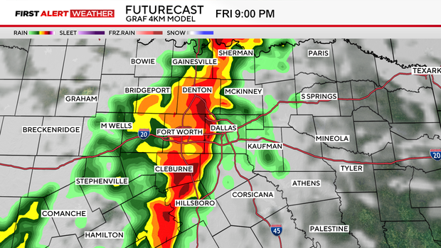
Heavy rain and some strong to severe storms are forecasted to hit the Metroplex between 7-11 p.m.
The storms will track east by sunrise Saturday morning, but models indicate more rain is possible Saturday evening into Sunday morning.
The flooding risk will increase starting on Saturday morning, as widespread 1" – 3" rainfall totals are expected across North Texas.
A few more strong to severe storms with large hail are possible.
The last of the rain should clear out by Sunday, leaving a seasonal and drier week ahead.