Another hot January day for North Texas Thursday before seasonable weather returns this weekend
DFW Airport logged 0.01" of rain just before lunch on Thursday. This is the first measurable rain at the airport in three weeks.
The temperature hit a high of 80°, thanks to the afternoon sun and very strong winds. Gusts hit 40mph in places. That makes for the ninth time this winter that DFW's high was at 80 or higher. We are not even halfway through winter, and that is one away from tying for the second most ever.
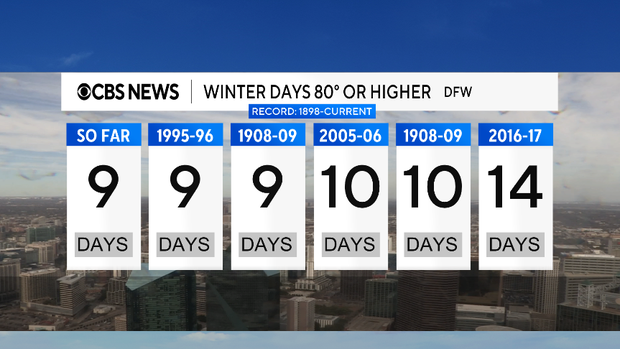
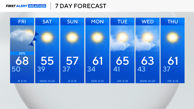
This is the second-warmest winter on record to date. Cooler air is finally on its way. Another cold front comes in on Friday. It will bring rain chances to North Texas. Almost all of this rain will be from the metroplex to the east; some storms are possible as well.
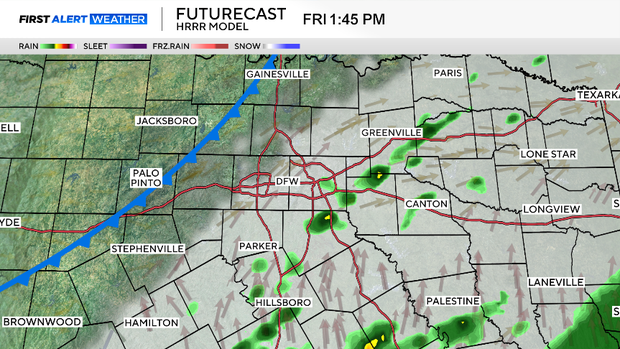
Rain chances are modest, about 20% for the metroplex and around 40% chance for our eastern edge.
The winds pick up again overnight and Saturday, and these north winds bring in colder air. Wind chills by Saturday morning will be around freezing; highs both Saturday and Sunday will be in the mid-50s. These are temperatures that are typical of the time of year.
Dry weather sets in again; we are not expecting rain next week.
Please be aware that until we can get some significant rain in this area, anytime the wind picks up, there will be an elevated grass fire risk. No outdoor burning, please.