Warm weather continues in North Texas with rain chances on the way
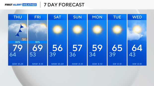
It has been another well-above-average day. In fact, temperatures across North Texas rose into the upper 70s and 80s Wednesday. It definitely does not feel like winter; the average high temperature for this time of the year should be 56 degrees.
Wednesday night will be pleasant and spring-like. Temperatures will dip into the 60s around 8 pm.
Thursday morning will start warm; the low temperature will be around 10 degrees warmer than what the high temperature should be. The high for Thursday will once again be in the 70s with winds from the southwest, gusting up to 30 mph at times.
A disturbance is forecasted to move across the northwestern counties overnight into Thursday morning, increasing the risk for a few strong and severe isolated storms. Not everyone will see rain or storms, but the potential of 60 mph winds and quarter-sized hail is a possibility.
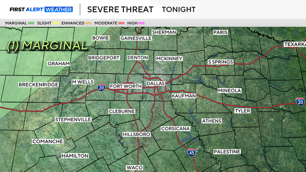
On Thursday, the threat for severe weather is still possible, but lower end across the Red River Valley. As for the metroplex, there is a small chance for rain and potentially a rumble of thunder; however, most of the area will remain dry.
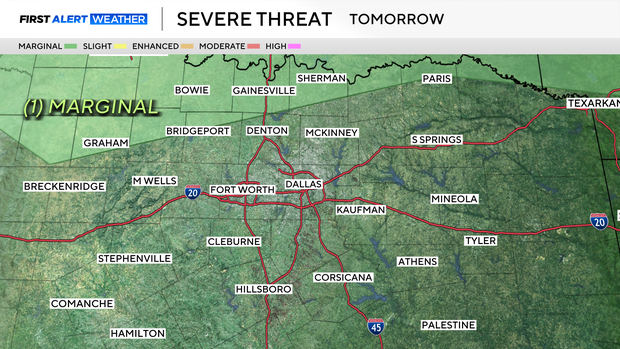
By Friday, more storms will fire up in the afternoon east of I-35.
The high Friday will be highly dependent on the timing of the front as it sweeps across the area. By the weekend, the front fully pushes across the region and ushers in a cooler and drier airmass. This weekend looks to be breezy, sunny, and seasonal with highs in the 50s.