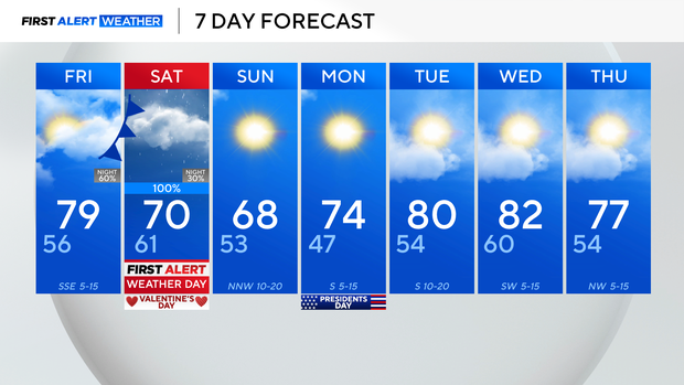
Temperatures in North Texas remain above average ahead of heavy rain on Saturday
Temperatures across North Texas have been climbing by the day, with highs around 15° above average on Thursday afternoon.
We continue to warm into Friday, with highs in the upper 70s to near 80°. Expect mainly dry conditions for about all of Friday, we will just be cloudier, with clouds gradually building all day until our incoming system arrives overnight and into Saturday.

We have issued a First Alert Weather day for Saturday, for widespread, disruptive rain, with beneficial rain totals for much of the region.
We are well below average as far as rain is concerned for the winter season, with much of North Texas under some level of drought, so the moisture is needed.
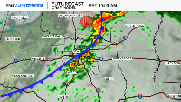
The bulk of the heavier showers and thunderstorms will move through between about mid-morning and early-afternoon Saturday as our first cold front rolls through.
A secondary front on its heels brings a few additional, but more scattered showers during the late-afternoon and evening timeframe.
Rain totals look to range from about 0.5"-1.5", with isolated higher totals east of I-35.
That rain wraps up late Saturday, then Sunday is nicer, with sunshine, and highs in the upper 60s. We will be a bit breezy.
From there, expect a steady warming trend into next week, with highs near 80 by Tuesday.