The high heat is back in North Texas. Expect temperatures in the upper 80s, 90s as fire danger elevates
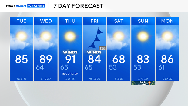
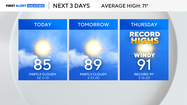
Tuesday begins mild, with temperatures in the 50s and 60s across the Dallas-Fort Worth Metroplex.
The warmth will continue with highs in the mid-80s by Tuesday afternoon, which will eventually reach the 90s by Thursday. The record high on Thursday is 91°, and the First Alert Weather Team is forecasting 91° and an abundance of southerly winds.
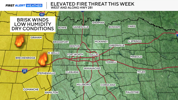
Due to the dry, low-humidity conditions, the fire threat continues in the western counties.
Expect wind to increase on Thursday and Friday ahead of a cold front that will drop temperatures into the 60s on Saturday. Wind gusts will likely stay between 25 and 30 mph at times.
There is only a slim chance of rainfall on Friday night and into Saturday; the dry conditions continue.
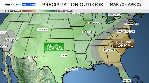
Looking ahead to early April, the Climate Prediction Center has forecast that DFW has a chance to receive above-normal amounts of precipitation, which is much needed as most of the Lone Star State is seeing drought conditions.
Out of the next seven days, only one day will be below average as above-average temperatures continue. This likely sets the stage for this March to wind up being the warmest ever on record.