Cold front moving in overnight will bring storms to North Texas
Despite a dryline moving into the area Tuesday, the CAP held on and storm activity was limited through the afternoon and evening. But a cold front moving through overnight into Wednesday morning will assuredly bring storms to parts of North Texas.
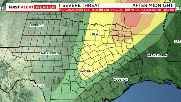
The Storm Predication Center has parts of North Texas along and to the east of I-35 under a level 2/slight risk for severe storms after midnight. The farther north and east you go, the threat increases to a level 3/enhanced risk. The main threats we're watching for are large hail and damaging winds.
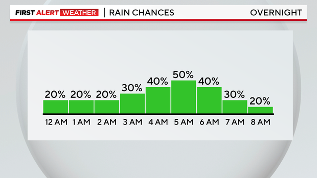
Storms are expected to begin after 2 a.m. and continue through sunrise. As the cold front reaches the 35 corridor, we'll watch for storm development that will quickly move east.
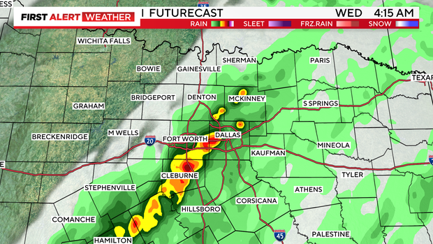
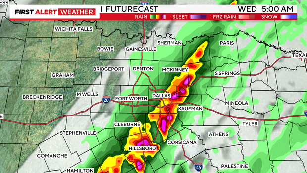
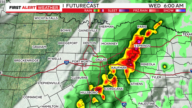
West of 35, you likely won't see much of anything. And hopefully most of North Texas sleeps through the storms with little to no impact. But for those that head out the door early, particularly between 4 and 5 a.m., you'll want to be prepared for some activity on radar if you live to the east of the metroplex.
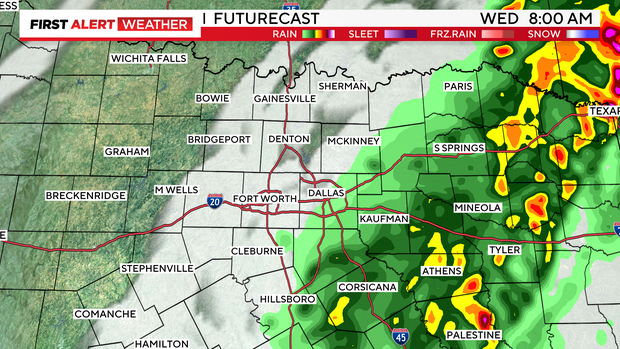
By midday Wednesday, we should be clear of rain and storms and seeing sunshine. Highs will be near 70°. Cooler temperatures in the 60s are expected for Thursday and Friday afternoon, but warmer temperatures return for the weekend.