Another round of showers and storms arrives late Monday into Tuesday
FORT WORTH, Texas (CBSDFW.COM) — Here's what we're tracking in the forecast:
- Areas of mist and drizzle will give way to mostly cloudy skies today (maybe a little sun this afternoon).
- Heads up! We're tracking another round of showers and potential strong to severe storms late Monday into Tuesday as a cold front moves through.
- Much cooler weather later in the work week.
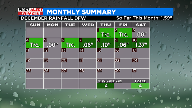
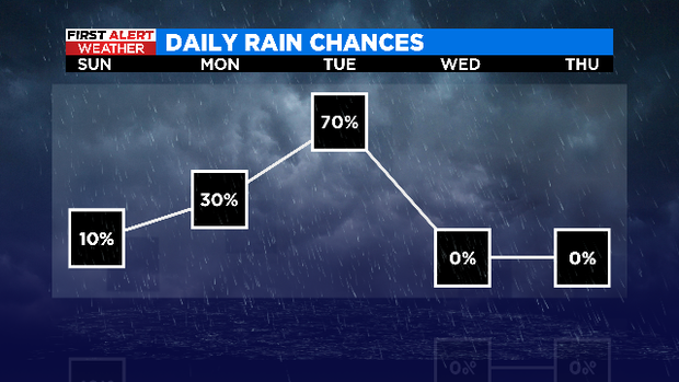
Yesterday, DFW picked up 1.37" of rain! Wow.
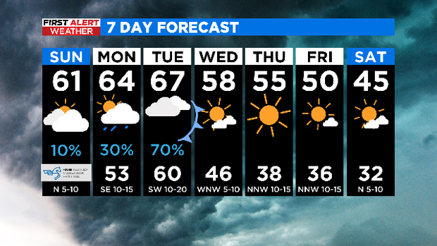
For today, we started the morning with low clouds, fog, mist and drizzle at the BMW Dallas Marathon. Gradually, as we move through the day, we'll see the spotty light showers go away, and in turn, we'll see mostly cloudy skies. Some sunshine is possible today, but more clouds than sun will likely be the rule. High temperatures will be in the upper 50s and lower 60s this afternoon.

Next week, let's prepare for more rain and even more storms.
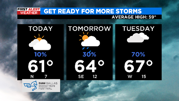
On Monday, we'll see mostly cloudy skies and some spotty showers developing through the day in advance of a cold front. The highest chances for rain will arrive late afternoon and evening (20-30%). But by late Monday night into Tuesday, we need to be weather aware.
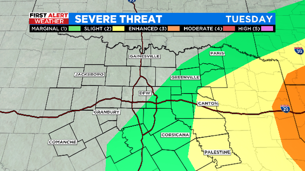
As the cold front pushes through on Tuesday, we'll likely have a line of rain and thunderstorms moving through during the morning and the afternoon from west to east. Some of the rain will be heavy.
There's also a chance for strong to severe thunderstorms on Tuesday. Gusty winds and heavy rain are the big threats, but we can't rule out an isolated tornado either. Rain chances are around 70% Tuesday. The worst weather will likely be to the east.
We'll be dry and cooler into Wednesday and Thursday. Highs will be in the 50s. Even colder weather is expected by next weekend.