Pittsburgh Weather: Getting A Clearer View Of This Week's Winter Storms
PITTSBURGH (KDKA) - We are getting a clearer view of the timing of the Thursday and Friday winter storms that will impact the area.
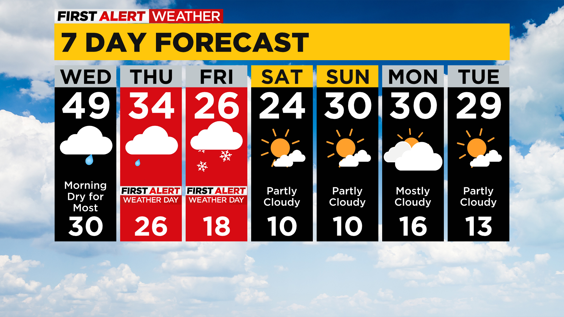
It is still too early to know what to expect exactly when it comes to snow totals, this is due to the uncertainty of when exactly we see the change over from freezing rain to sleet to snow.
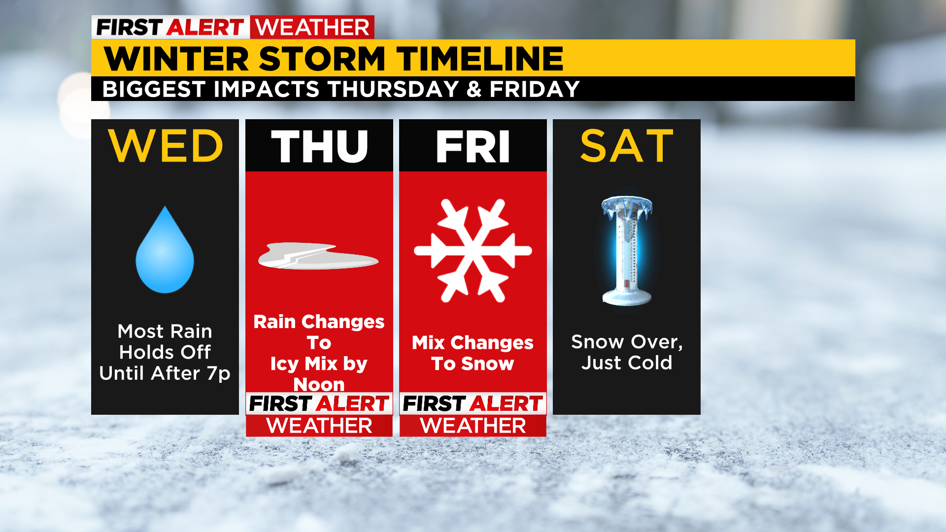
Right Now: A Winter Storm Watch has been issued beginning Thursday (1:00 a.m.) and going through 10:00 a.m. on Friday.
Alert: Rain, freezing rain, and snow will impact the area as soon as Wednesday night. Over a quarter-inch of freezing rain is now expected. This is different from ice Snow totals, for now, will be 3-6". Things could still change, especially when it comes to snow totals…
Aware: There is currently around 7" of snow on the ground, and ice chunks on rivers. With the addition of an inch and a half of rain over 36 hours, along with snow melt, and potential ice damming, river flooding will be possible this weekend. River rises of a couple of inches probably is needed before river flooding becomes an issue according to NWS.
When it comes to timing, it will depend on your exact location with what and when you will see it.
WEATHER LINKS:
Current Conditions | School Delays & Closings | Local Radar | Weather App | Photos
For places north of I-80, this is pretty much a straight snow event for you with temperatures cold enough to see nearly all snow. Starting along I-80 and moving to the Butler-Allegheny county lines, we will see a brief round of maybe two hours of freezing rain before sunrise on Thursday.

The rest of the day will see all snow for you.
If you are in Allegheny County to I-70 you are looking at the potential for several hours of freezing rain that will slow traffic down to nearly a stand still at times. Freezing rain could begin as soon as 7:00 a.m., and I expect the chance for freezing rain to continue through AT LEAST 7:00 p.m. on Thursday.
Once we see a changeover to snow, the snow will continue through Friday afternoon.
It is going to be a busy 24-36 hours of winter weather.
Things get a little more complicated for places south of I-80. You are not included, for now, in the winter storm watch area. I think this is likely to change with freezing rain and drizzle being possible for you Thursday afternoon to evening.
Snow showers will impact places south of I-80 for the rest of the day on Friday.
Stay up to date with the KDKA app, which you can download here.